Approximate Location Map
Large Map »
Latitude: 51.2827 / 51°16'57"N
Longitude: 1.0729 / 1°4'22"E
OS Eastings: 614393
OS Northings: 158215
OS Grid: TR143582
Mapcode National: GBR TY2.G2X
Mapcode Global: VHLGM.K120
Plus Code: 9F3373MF+35
Entry Name: The Unicorn Inn
Listing Date: 7 September 1973
Grade: II
Source: Historic England
Source ID: 1260311
English Heritage Legacy ID: 441118
Also known as: The Unicorn Inn, Canterbury West, Canterbury
Unicorn Inn
ID on this website: 101260311
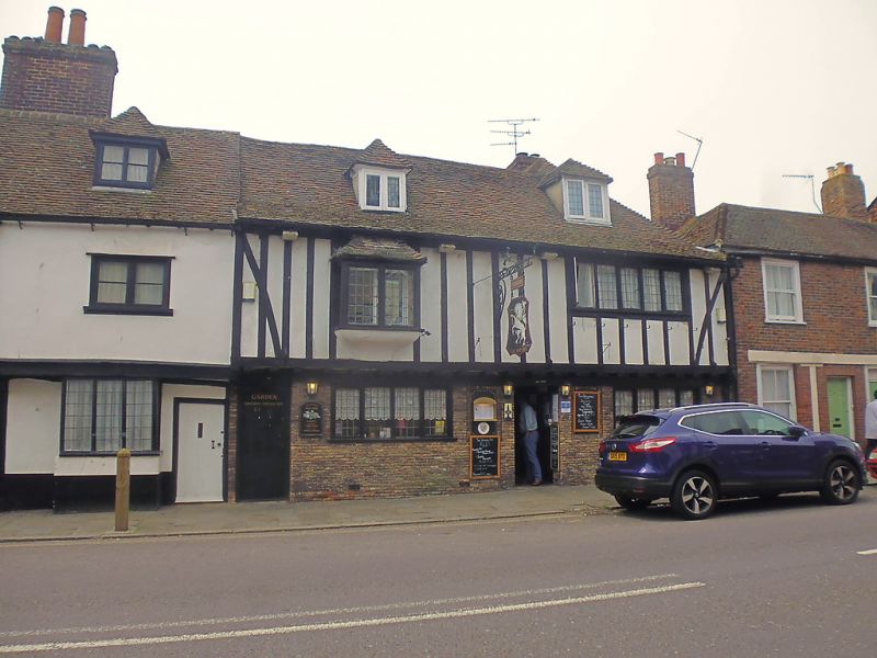
1.
944 ST DUNSTAN'S STREET
(South West Side)
No 6l
(The Unicorn Inn)
TR 1458 SW 1/322A
II GV
2.
A timber-framed building with plaster infilling very much restored, the ground
floor faced in red brick. The 1st floor oversails. 2 storeys and attics.
Tiled roof with 2 hipped dormers. 2 mod rn casement windows.
Nos 51 to 66 (consec) form a group.
Listing NGR: TR1438858208
External links are from the relevant listing authority and, where applicable, Wikidata. Wikidata IDs may be related buildings as well as this specific building. If you want to add or update a link, you will need to do so by editing the Wikidata entry.


Other nearby listed buildings
