Approximate Location Map
Large Map »
Latitude: 51.282 / 51°16'55"N
Longitude: 1.0756 / 1°4'32"E
OS Eastings: 614580
OS Northings: 158142
OS Grid: TR145581
Mapcode National: GBR TY2.GS0
Mapcode Global: VHLGM.L1GK
Plus Code: 9F3373JG+Q6
Entry Name: 1 and 2, North Lane
Listing Date: 7 September 1973
Grade: II
Source: Historic England
Source ID: 1260670
English Heritage Legacy ID: 440041
ID on this website: 101260670
Location: Canterbury, Kent, CT2
County: Kent
District: Canterbury
Electoral Ward/Division: Westgate
Parish: Non Civil Parish
Built-Up Area: Canterbury
Traditional County: Kent
Lieutenancy Area (Ceremonial County): Kent
Tagged with: Building
1.
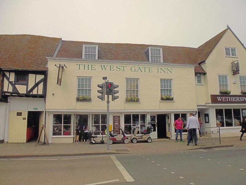
944 NORTH LANE
(North West Side)
Nos 1 & 2
TR 1458 SE 2/342
II GV
2.
A timber-framed building refaced in the C18. 2 storeys painted brick. Tiled
roof with 2 dormers and moulded eaves cornice. J windows without glazing bars.
Later shop front.
Nos 1, 2 & Nos 4 to 15 (consec) form a group.
Listing NGR: TR1458158152
External links are from the relevant listing authority and, where applicable, Wikidata. Wikidata IDs may be related buildings as well as this specific building. If you want to add or update a link, you will need to do so by editing the Wikidata entry.


Other nearby listed buildings
