Approximate Location Map
Large Map »
Latitude: 51.2821 / 51°16'55"N
Longitude: 1.0757 / 1°4'32"E
OS Eastings: 614592
OS Northings: 158155
OS Grid: TR145581
Mapcode National: GBR TY2.GT2
Mapcode Global: VHLGM.L1KG
Plus Code: 9F3373JG+R7
Entry Name: The Falstaff Tap
Listing Date: 7 September 1973
Grade: II
Source: Historic England
Source ID: 1260677
English Heritage Legacy ID: 440042
ID on this website: 101260677
Location: Canterbury, Kent, CT2
County: Kent
District: Canterbury
Electoral Ward/Division: Westgate
Parish: Non Civil Parish
Built-Up Area: Canterbury
Traditional County: Kent
Lieutenancy Area (Ceremonial County): Kent
Tagged with: Architectural structure
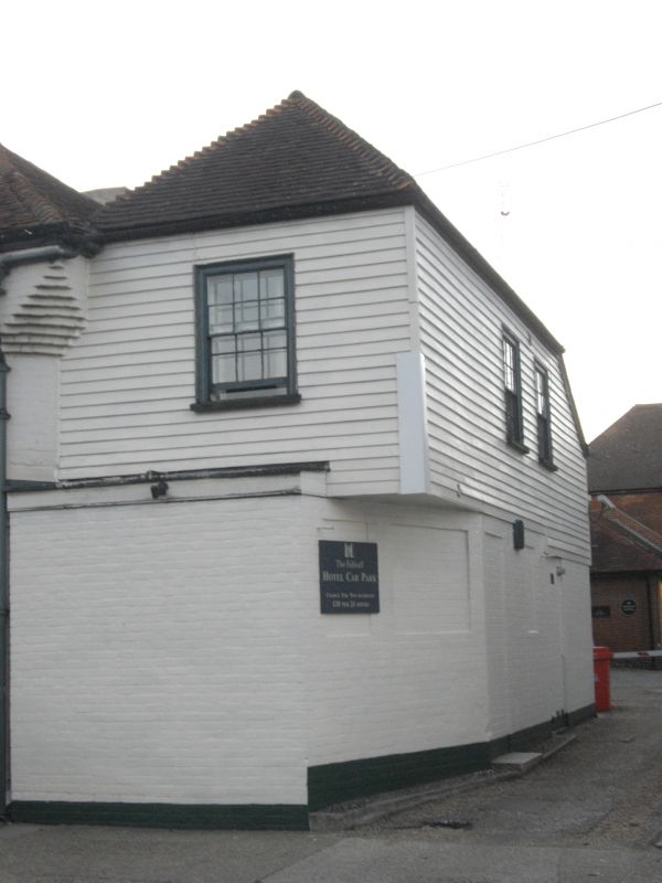
1.
944 NORTH LANE
(North West Side)
No 4
(The Falstaff Tap)
TR 1458 SE 2/343
II GV
2.
C18. 2 storeys painted brick. Old tiled roof hipped at one end. Rounded
corner. 3 sashes with glazing bars intact. The grand floor has 2 shopfronts
and 2 doorcases, one of which is round-headed.
Nos 1, 2 & Nos 4 to 15 (consec) form a group.
Listing NGR: TR1458358156
External links are from the relevant listing authority and, where applicable, Wikidata. Wikidata IDs may be related buildings as well as this specific building. If you want to add or update a link, you will need to do so by editing the Wikidata entry.


Other nearby listed buildings
