Approximate Location Map
Large Map »
Latitude: 51.2833 / 51°16'59"N
Longitude: 1.085 / 1°5'6"E
OS Eastings: 615232
OS Northings: 158314
OS Grid: TR152583
Mapcode National: GBR TY2.K3T
Mapcode Global: VHLGM.R0GK
Plus Code: 9F3373MP+82
Entry Name: 46, Northgate
Listing Date: 7 September 1973
Grade: II
Source: Historic England
Source ID: 1260715
English Heritage Legacy ID: 439941
ID on this website: 101260715
Location: Northgate, Canterbury, Kent, CT1
County: Kent
District: Canterbury
Electoral Ward/Division: Northgate
Parish: Non Civil Parish
Built-Up Area: Canterbury
Traditional County: Kent
Lieutenancy Area (Ceremonial County): Kent
Tagged with: Building
1.
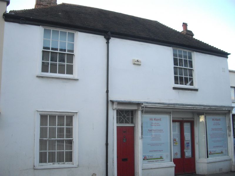
944 NORTHGATE
(North West Side)
No 46
TR 1558 SW 3/589
II GV
2.
C18. 2 storeys stuccoed, Hipped renewed tiled roof. 2 sashes with glazing
bars intact in moulded architrave. C19 shop front and left side doorcase with
rectangular fanlight and pilasters.
Nos 46 to 48 (consec) and Gatehouse to St John's Hospital from a group.
Listing NGR: TR1523458331
External links are from the relevant listing authority and, where applicable, Wikidata. Wikidata IDs may be related buildings as well as this specific building. If you want to add or update a link, you will need to do so by editing the Wikidata entry.


Other nearby listed buildings
