Latitude: 54.8936 / 54°53'36"N
Longitude: -1.7088 / 1°42'31"W
OS Eastings: 418776
OS Northings: 555467
OS Grid: NZ187554
Mapcode National: GBR JCHV.VK
Mapcode Global: WHC42.Q8HB
Plus Code: 9C6WV7VR+CF
Entry Name: Wray Tomb Circa 6 Metres South East of Church of St Margaret
Listing Date: 21 January 1987
Grade: II
Source: Historic England
Source ID: 1260784
English Heritage Legacy ID: 439452
ID on this website: 101260784
Location: St Margaret's Church, Tanfield, County Durham, DH9
County: County Durham
Civil Parish: Stanley
Traditional County: Durham
Lieutenancy Area (Ceremonial County): County Durham
Church of England Parish: Tanfield
Church of England Diocese: Durham
Tagged with: Tomb
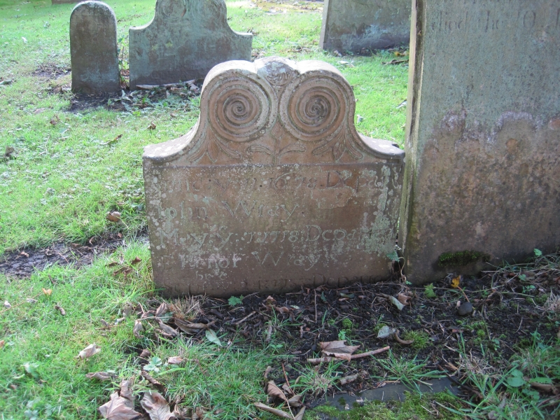
NZ 1855 STANLEY FRONT STREET (North side) Tanfield 18/172 Wray tomb c.6 metres south-east of Church of St. Margaret GV II Headstone. Circa 1678. To John Wray. Sandstone slab about ½ metre high with scrolled top, the scrolls flanking simple foliage. The Wray family lived in Beamish Hall (q.v.), but had their estate sequestered after the Civil War. Included for historical interest.
Listing NGR: NZ1877655467
External links are from the relevant listing authority and, where applicable, Wikidata. Wikidata IDs may be related buildings as well as this specific building. If you want to add or update a link, you will need to do so by editing the Wikidata entry.


Other nearby listed buildings