Approximate Location Map
Large Map »
Latitude: 51.2769 / 51°16'36"N
Longitude: 1.0865 / 1°5'11"E
OS Eastings: 615365
OS Northings: 157606
OS Grid: TR153576
Mapcode National: GBR TY2.ZFH
Mapcode Global: VHLGM.S57H
Plus Code: 9F3373GP+PH
Entry Name: 51 and 51A, Ivy Lane
Listing Date: 7 September 1973
Grade: II
Source: Historic England
Source ID: 1260800
English Heritage Legacy ID: 439382
ID on this website: 101260800
Location: Canterbury, Kent, CT1
County: Kent
District: Canterbury
Electoral Ward/Division: Barton
Parish: Non Civil Parish
Built-Up Area: Canterbury
Traditional County: Kent
Lieutenancy Area (Ceremonial County): Kent
Tagged with: Building
1.
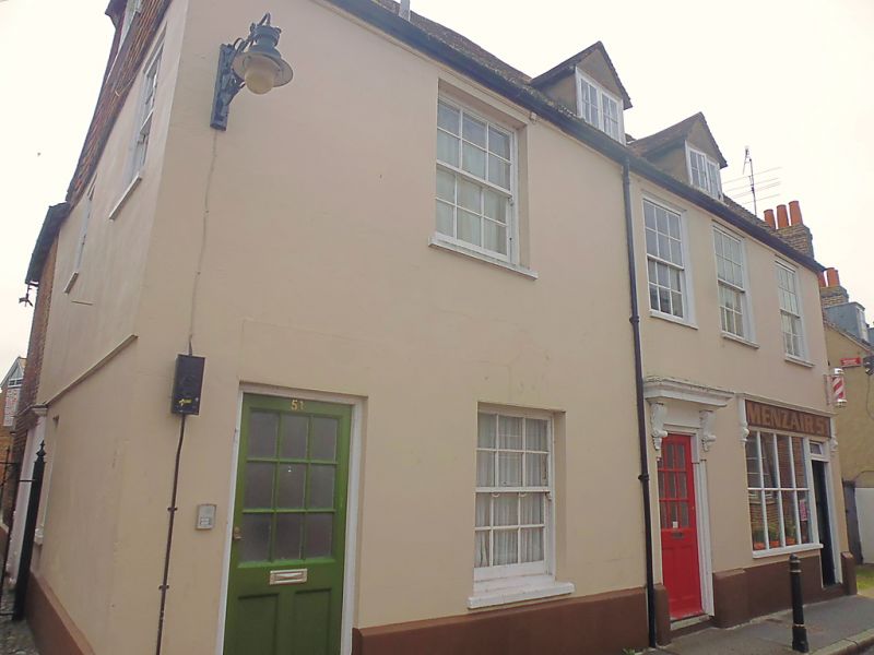
944 IVY LANE
(South Side)
Nos 51 and 5lA
TR 1557 NW 5/5l7
II GV
2.
C18. 2 storeys stuccoed. Half-hipped tiled roof with 2 hipped dormers.
4 sashes in all with glazing bars intact. No 51 has a simple doorcase.
No 52 has a left side doorcase with half-hood on moulded console brackets
and early C19 shopfront.
Nos 40A to 45 (consec), No 51, No 51A, Nos 53 to 61 (consec) and
NO 63 form a group.
Listing NGR: TR1536657601
External links are from the relevant listing authority and, where applicable, Wikidata. Wikidata IDs may be related buildings as well as this specific building. If you want to add or update a link, you will need to do so by editing the Wikidata entry.


Other nearby listed buildings
