Latitude: 53.1649 / 53°9'53"N
Longitude: -1.1944 / 1°11'39"W
OS Eastings: 453958
OS Northings: 363392
OS Grid: SK539633
Mapcode National: GBR 8DZ.QT7
Mapcode Global: WHDFS.MQG2
Plus Code: 9C5W5R74+X7
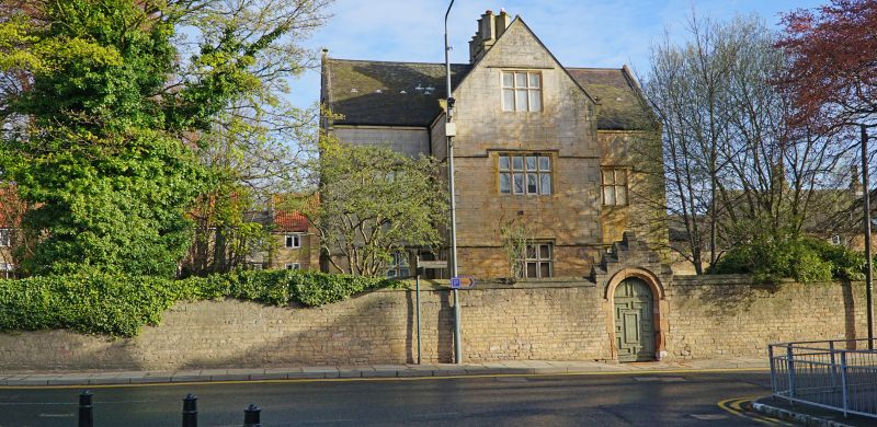
Entry Name: Boundary Wall and Gate at Number 2
Listing Date: 22 October 1986
Grade: II
Source: Historic England
Source ID: 1261232
English Heritage Legacy ID: 434722
ID on this website: 101261232
Location: Mansfield Woodhouse, Mansfield, Nottinghamshire, NG19
County: Nottinghamshire
District: Mansfield
Electoral Ward/Division: Woodhouse
Parish: Non Civil Parish
Built-Up Area: Mansfield Woodhouse
Traditional County: Nottinghamshire
Lieutenancy Area (Ceremonial County): Nottinghamshire
Church of England Parish: Mansfield Woodhouse
Church of England Diocese: Southwell and Nottingham
Tagged with: Wall
MANSFIELD WOODHOUSE STATION STREET SK 5363 SE and SK 5463 SW (north side) 6/64 and 7/64 Boundary wall and gate at No.2 G.V. II Boundary wall. C19. Coursed squared rubble. Gabled ashlar and half-round dressed stone coping. South side has a pair of panelled square gatepiers with pyramidal caps. To their right, C19 wicket gate in C17 style. Moulded round headed opening with hood mould and stepped coped gable. Panelled door with strap hinges. Approx. 150M long.
Listing NGR: SK5395863392
External links are from the relevant listing authority and, where applicable, Wikidata. Wikidata IDs may be related buildings as well as this specific building. If you want to add or update a link, you will need to do so by editing the Wikidata entry.


Other nearby listed buildings