Approximate Location Map
Large Map »
Latitude: 54.4706 / 54°28'14"N
Longitude: -0.6291 / 0°37'44"W
OS Eastings: 488942
OS Northings: 509224
OS Grid: NZ889092
Mapcode National: GBR SJ1R.L5
Mapcode Global: WHG9Y.9WNN
Plus Code: 9C6XF9CC+69
Entry Name: 34, High Street
Listing Date: 23 February 1954
Grade: II
Source: Historic England
Source ID: 1261703
English Heritage Legacy ID: 436822
ID on this website: 101261703
Location: Ruswarp, North Yorkshire, YO21
County: North Yorkshire
District: Scarborough
Civil Parish: Whitby
Built-Up Area: Whitby
Traditional County: Yorkshire
Lieutenancy Area (Ceremonial County): North Yorkshire
Tagged with: Building
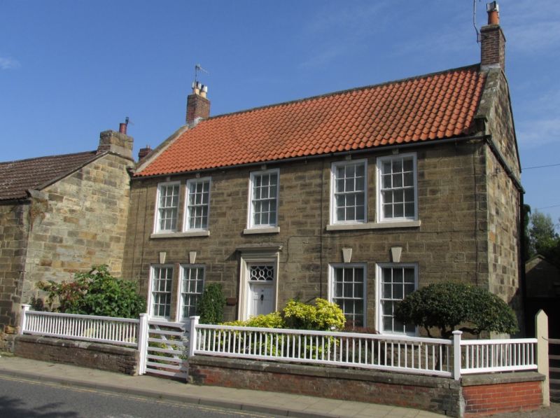
1.
18ll HIGH STREET
(East Side)
RUSWARP
No 34
NZ 8809 10/226 23.2.54.
II GV
2.
Cl8. 2 storeys in stone. Pantile roof with stone capped gables. 5 cased
sash windows with glazing bars, the outer ones in pairs; keyblocks. Central
6-panel door with ornamental fanlight and architrave with pulvinated frieze
and cornice.
Nos 22 to 26 (even), Unicorn Public House, and Nos 32 and 34 form a group.
Listing NGR: NZ8894209224
External links are from the relevant listing authority and, where applicable, Wikidata. Wikidata IDs may be related buildings as well as this specific building. If you want to add or update a link, you will need to do so by editing the Wikidata entry.


Other nearby listed buildings
