Approximate Location Map
Large Map »
Latitude: 51.0661 / 51°3'58"N
Longitude: -1.7971 / 1°47'49"W
OS Eastings: 414310
OS Northings: 129663
OS Grid: SU143296
Mapcode National: GBR 51F.2GR
Mapcode Global: FRA 7639.KPL
Plus Code: 9C3W3683+F4
Entry Name: 27, the Close
Listing Date: 28 February 1952
Grade: II*
Source: Historic England
Source ID: 1261925
English Heritage Legacy ID: 319004
ID on this website: 101261925
Location: The Friary, Wiltshire, SP1
County: Wiltshire
Civil Parish: Salisbury
Built-Up Area: Salisbury
Traditional County: Wiltshire
Lieutenancy Area (Ceremonial County): Wiltshire
Tagged with: Building
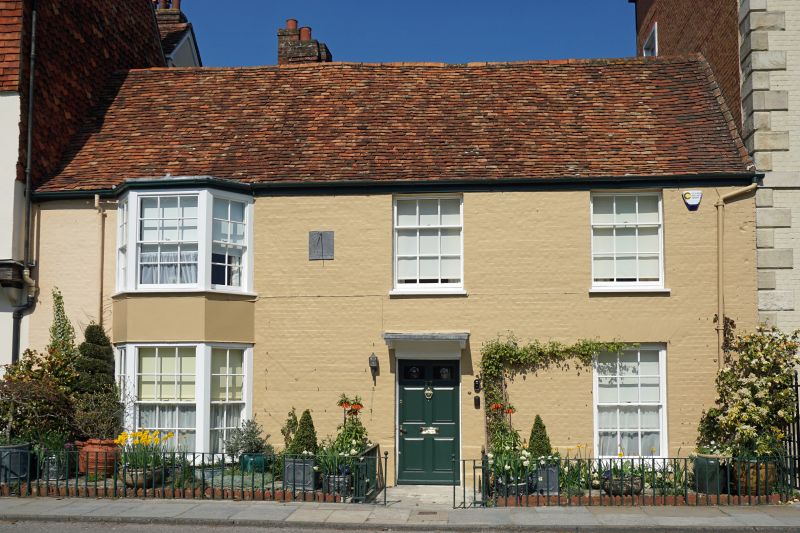
THE CLOSE
1.
1594
No 27
SU 1429 NW 3/34 28.2.52
II* GV
2.
Mid Cl8 2 storeys colourwashed brick. Gable end old tile roof. Superimposed
canted bay windows to left of front and 2 windows on lst floor, one on ground
floor, flush framed sashes, glazing bars intact. Central door of 6 fielded
panels under flat stone hood on cut stone brackets.
All the listed buildings in the Close form an outstanding group.
Listing NGR: SU1431229662
External links are from the relevant listing authority and, where applicable, Wikidata. Wikidata IDs may be related buildings as well as this specific building. If you want to add or update a link, you will need to do so by editing the Wikidata entry.


Other nearby listed buildings
