Latitude: 51.5154 / 51°30'55"N
Longitude: -0.105 / 0°6'17"W
OS Eastings: 531587
OS Northings: 181313
OS Grid: TQ315813
Mapcode National: GBR NB.KY
Mapcode Global: VHGR0.45BM
Plus Code: 9C3XGV8W+52
Entry Name: Hoop and Grapes Public House
Listing Date: 17 June 1991
Grade: II
Source: Historic England
Source ID: 1262397
English Heritage Legacy ID: 435161
Also known as: Hoop and Grapes, Farringdon Street
Hoop & Grapes
ID on this website: 101262397
Location: Holborn, City of London, London, EC4A
County: London
District: City and County of the City of London
Electoral Ward/Division: Farringdon Within
Parish: Non Civil Parish
Built-Up Area: City of London
Traditional County: Middlesex
Lieutenancy Area (Ceremonial County): City of London
Church of England Parish: St Bride Fleet Street
Church of England Diocese: London
Tagged with: Pub
FARRINGDON STREET 1. 500 0/D NO 80 Hoop & Grapes Public House TQ 3181 SE
II
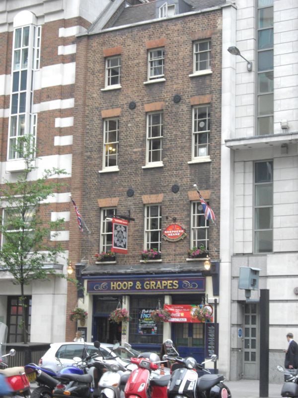
2. Terraced house. c1720 built for a vintner, converted to a public house c1832 and used as such until 1991. Re-faced following war damage with multi-coloured stock brick and red brick dressings. Double-pitched roof with penthouse on south party wall; C20 tiles but original pegged and numbered timbers. 4 storeys and cellars. 3 windows. Ground floor public house front probably C20. Upper floors retain early C19 sashes with margin glazing; gauged red brick flat arches and red brick pilaster strip to left hand angle. Parapet. Interior ground floor altered in C20 but retains 1830 staircase to first floor. From first floor a good c1720 dog- leg stair having column newels base balusters and pendants; plain panelled dado. Upper floors retain original plan form with some later partitioning; some original doorframes and a plain panelled door. 1st floor wide room across the front of the house with c1830 cornice and skirting. 2nd and 3rd floors with half height square panelling and original beams. Basement has brick vaults thought to be part of C17 warehousing vaults built in connection with the formation of the Fleet Canal. Built on part of the site of St. Bride's Burial Ground.
Listing NGR: TQ3158781313
External links are from the relevant listing authority and, where applicable, Wikidata. Wikidata IDs may be related buildings as well as this specific building. If you want to add or update a link, you will need to do so by editing the Wikidata entry.


Other nearby listed buildings