Approximate Location Map
Large Map »
Latitude: 51.3544 / 51°21'15"N
Longitude: -2.001 / 2°0'3"W
OS Eastings: 400026
OS Northings: 161699
OS Grid: SU000616
Mapcode National: GBR 2V0.4WK
Mapcode Global: VHB4G.87H2
Plus Code: 9C3V9X3X+PJ
Entry Name: The Town Bridge
Listing Date: 9 April 1954
Grade: II
Source: Historic England
Source ID: 1262655
English Heritage Legacy ID: 434461
ID on this website: 101262655
Location: Devizes, Wiltshire, SN10
County: Wiltshire
Civil Parish: Devizes
Built-Up Area: Devizes
Traditional County: Wiltshire
Lieutenancy Area (Ceremonial County): Wiltshire
Church of England Parish: Devizes St Peter
Church of England Diocese: Salisbury
Tagged with: Bridge
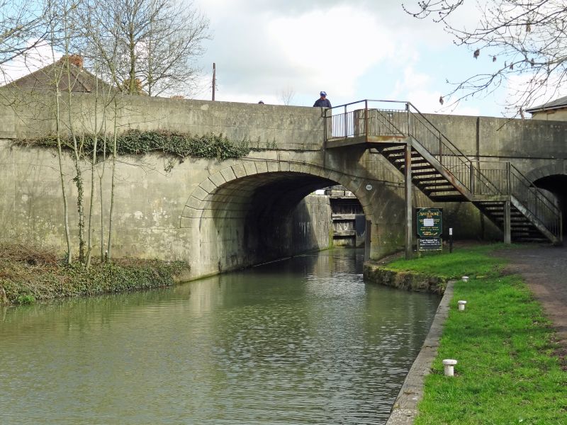
1.
1042 THE NURSERY
The Town Bridge
SU 0061 2/180 9.4.54.
II
2.
Early Cl9. Ashlar, presumably Bath stone. A plain 3-centred arch with chamfered
voussoir band, with similar smaller arch over tow path. Plain string at road
level and solid parapet.
Listing NGR: SU0002661699
External links are from the relevant listing authority and, where applicable, Wikidata. Wikidata IDs may be related buildings as well as this specific building. If you want to add or update a link, you will need to do so by editing the Wikidata entry.


Other nearby listed buildings
