Latitude: 53.343 / 53°20'34"N
Longitude: -1.7762 / 1°46'34"W
OS Eastings: 414995
OS Northings: 382926
OS Grid: SK149829
Mapcode National: GBR JY1S.7B
Mapcode Global: WHCCL.P7CH
Plus Code: 9C5W86VF+6G
Entry Name: K6 Telephone Kiosk
Listing Date: 17 March 1989
Grade: II
Source: Historic England
Source ID: 1263002
English Heritage Legacy ID: 82562
ID on this website: 101263002
Location: Castleton, High Peak, Derbyshire, S33
County: Derbyshire
District: High Peak
Civil Parish: Castleton
Built-Up Area: Castleton
Traditional County: Derbyshire
Lieutenancy Area (Ceremonial County): Derbyshire
Church of England Parish: Castleton St Edmund
Church of England Diocese: Derby
Tagged with: K6 telephone box
SK 18 SW CASTLETON CASTLE STREET
6/67
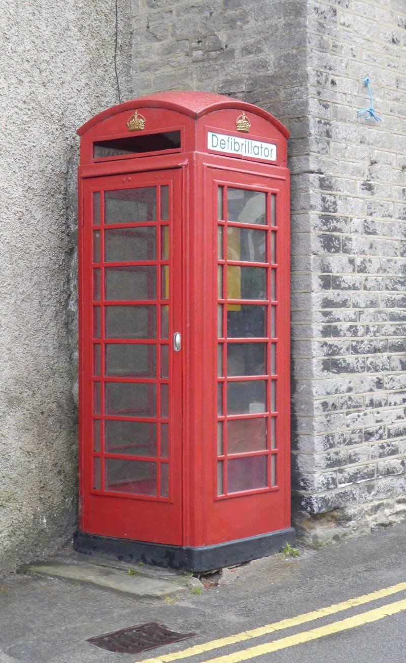
K6 Telephone Kiosk
GV
II
Telephone kiosk. Type K6. Designed 1935 by Sir Giles Gilbert Scott. Made by
various contractors. Cast iron. Square kiosk with domed roof. Unperforated
crowns to top panels and margin glazing to windows and door.
Listing NGR: SK1499582925
External links are from the relevant listing authority and, where applicable, Wikidata. Wikidata IDs may be related buildings as well as this specific building. If you want to add or update a link, you will need to do so by editing the Wikidata entry.


Other nearby listed buildings