Approximate Location Map
Large Map »
Latitude: 51.3523 / 51°21'8"N
Longitude: -1.9924 / 1°59'32"W
OS Eastings: 400622
OS Northings: 161465
OS Grid: SU006614
Mapcode National: GBR 2V1.133
Mapcode Global: VHB4G.F81P
Plus Code: 9C3W9225+W2
Entry Name: 9 and 10, Maryport Street
Listing Date: 19 September 1972
Grade: II
Source: Historic England
Source ID: 1263035
English Heritage Legacy ID: 433372
ID on this website: 101263035
Location: Devizes, Wiltshire, SN10
County: Wiltshire
Civil Parish: Devizes
Built-Up Area: Devizes
Traditional County: Wiltshire
Lieutenancy Area (Ceremonial County): Wiltshire
Church of England Parish: Devizes St John
Church of England Diocese: Salisbury
Tagged with: Building
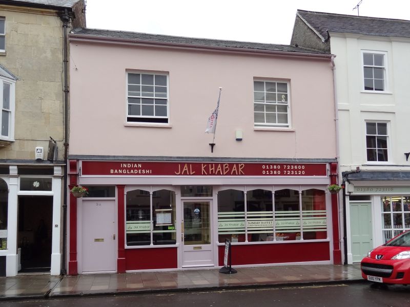
1.
1042 MARYPORT STREET
(East Side)
Nos 9 and 10
SU 0061 3a/274
II GV
2.
Early C19 considerably altered. 2 storeys rendered painted. Low pitch gable
end slate roof. Boxed eaves. 2 windows recessed with 3 panes to each sash,
block sills. Ground floor C20 shop front.
Nos 1 to l6 (consec) form a group.
Listing NGR: SU0051961478
External links are from the relevant listing authority and, where applicable, Wikidata. Wikidata IDs may be related buildings as well as this specific building. If you want to add or update a link, you will need to do so by editing the Wikidata entry.


Other nearby listed buildings
