Approximate Location Map
Large Map »
Latitude: 51.3506 / 51°21'2"N
Longitude: -1.9985 / 1°59'54"W
OS Eastings: 400203
OS Northings: 161284
OS Grid: SU002612
Mapcode National: GBR 2V0.CJT
Mapcode Global: VHB4G.99VY
Plus Code: 9C3W9222+7J
Entry Name: Walls Encircling Top of Castle Mound
Listing Date: 19 September 1972
Grade: II
Source: Historic England
Source ID: 1263774
English Heritage Legacy ID: 431450
ID on this website: 101263774
Location: Devizes, Wiltshire, SN10
County: Wiltshire
Civil Parish: Devizes
Built-Up Area: Devizes
Traditional County: Wiltshire
Lieutenancy Area (Ceremonial County): Wiltshire
Church of England Parish: Devizes St John
Church of England Diocese: Salisbury
Tagged with: Wall
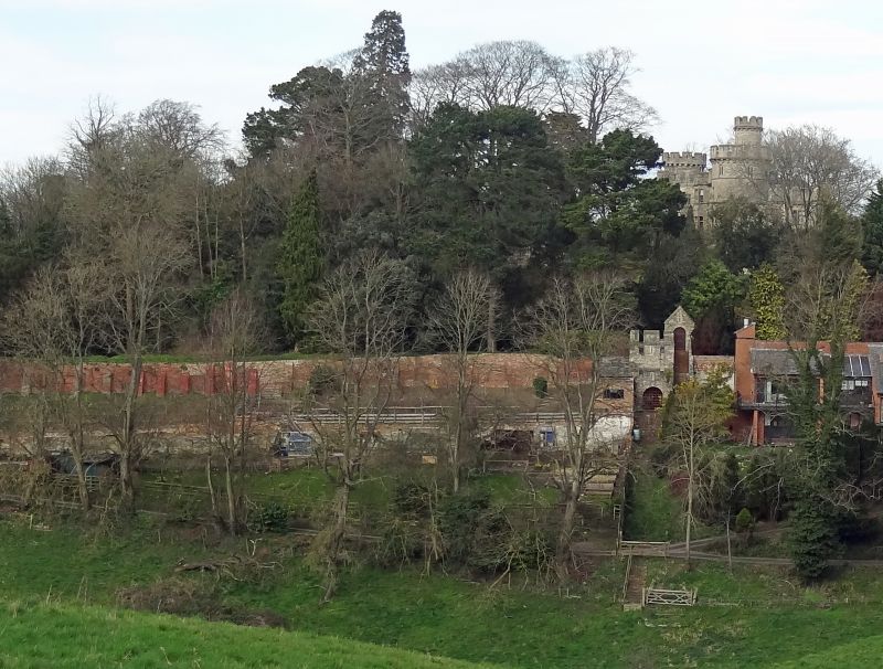
1. Walls encircling top of
1042 Castle Mound
SU 0061 2/217B
II
2.
Extensive rock faced, partly crenellated, walls encircle castle mound and
sunken garden. There are several Norman arched gateways under gables with
pierced openings.
Listing NGR: SU0020361284
External links are from the relevant listing authority and, where applicable, Wikidata. Wikidata IDs may be related buildings as well as this specific building. If you want to add or update a link, you will need to do so by editing the Wikidata entry.


Other nearby listed buildings
