Approximate Location Map
Large Map »
Latitude: 51.5262 / 51°31'34"N
Longitude: -0.0792 / 0°4'45"W
OS Eastings: 533345
OS Northings: 182561
OS Grid: TQ333825
Mapcode National: GBR V7.C2
Mapcode Global: VHGQT.KWZW
Plus Code: 9C3XGWGC+F8
Entry Name: 2 Posts Outside Number 74
Listing Date: 4 February 1975
Grade: II
Source: Historic England
Source ID: 1265103
English Heritage Legacy ID: 425963
ID on this website: 101265103
Location: Shoreditch, Hackney, London, EC2A
County: London
District: Hackney
Electoral Ward/Division: Hoxton East & Shoreditch
Parish: Non Civil Parish
Built-Up Area: Hackney
Traditional County: Middlesex
Lieutenancy Area (Ceremonial County): Greater London
Church of England Parish: St Leonard with S Michael, Shoreditch
Church of England Diocese: London
Tagged with: Building
RIVINGTON STREET EC2
1.
5013 (South Side)
--------------------
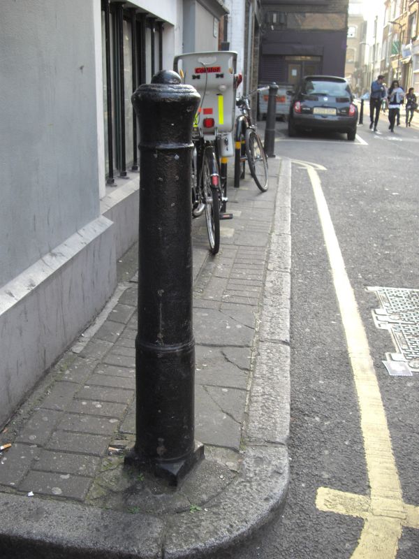
2 posts outside No 74
TQ 3382 35/532
II
2.
Early-mid C19 cast gunposts inscribed: "St. L.S. 1836,"
Listing NGR: TQ3334582561
External links are from the relevant listing authority and, where applicable, Wikidata. Wikidata IDs may be related buildings as well as this specific building. If you want to add or update a link, you will need to do so by editing the Wikidata entry.


Other nearby listed buildings
