Latitude: 51.4911 / 51°29'27"N
Longitude: -0.1652 / 0°9'54"W
OS Eastings: 527481
OS Northings: 178502
OS Grid: TQ274785
Mapcode National: GBR 7M.3N
Mapcode Global: VHGQZ.3S19
Plus Code: 9C3XFRRM+CW
Entry Name: The Gateways
Listing Date: 29 September 1993
Grade: II
Source: Historic England
Source ID: 1265189
English Heritage Legacy ID: 425781
ID on this website: 101265189
Location: Chelsea, Kensington and Chelsea, London, SW3
County: London
District: Kensington and Chelsea
Electoral Ward/Division: Royal Hospital
Parish: Non Civil Parish
Built-Up Area: Kensington and Chelsea
Traditional County: Middlesex
Lieutenancy Area (Ceremonial County): Greater London
Church of England Parish: St Luke and Christ Church Chelsea
Church of England Diocese: London
Tagged with: Building
The following building shall be added: WHITEHEAD'S GROVE TQ2778SW
249-/56/10001 The Gateways (includes the Gateways, Sprimont Place)
II
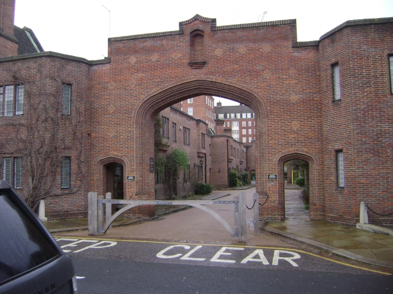
Houses. 1934 to the designs of Wills and Kaula. Brick in English and Flemish bond. Roofs of tile. Fills most of block between Whitehead's Grove and Sprimont Place, and arranged around two quadrangles, separated by College Place, which is entered through pointed diaphragm arches. Nominally in the Tudor Revival style, but pared down with an emphasis on broad expanses of brick and tile. Two and three storeys. Scattered fenestration. Roofs parapetted to interior ranges. Architectural effect generated by varied window arrangements and a limited range of architectural features, most noteworthy of which are shallow, projecting bays. Doors and casements of original designs. Noteworthy features include: stone pilastrade and stone colonnade at the centre of each quadrangle, the former set between canted bays and the latter punctuated by round-arched windows; rainwater furniture and plaques inscribed with dates. The listing includes units along Whitehead's Grove, finishing at the square turret near the corner. Specifically excluded are the corner shop, nos. 6 to 8 Elystan Street, and connected garage blocks (with housing over), nos. 44-66 (even) Elystan Place.
Listing NGR: TQ2748178502
External links are from the relevant listing authority and, where applicable, Wikidata. Wikidata IDs may be related buildings as well as this specific building. If you want to add or update a link, you will need to do so by editing the Wikidata entry.


Other nearby listed buildings