Latitude: 51.5003 / 51°30'1"N
Longitude: -0.1341 / 0°8'2"W
OS Eastings: 529611
OS Northings: 179578
OS Grid: TQ296795
Mapcode National: GBR GJ.1C
Mapcode Global: VHGQZ.MKG7
Plus Code: 9C3XGV28+49
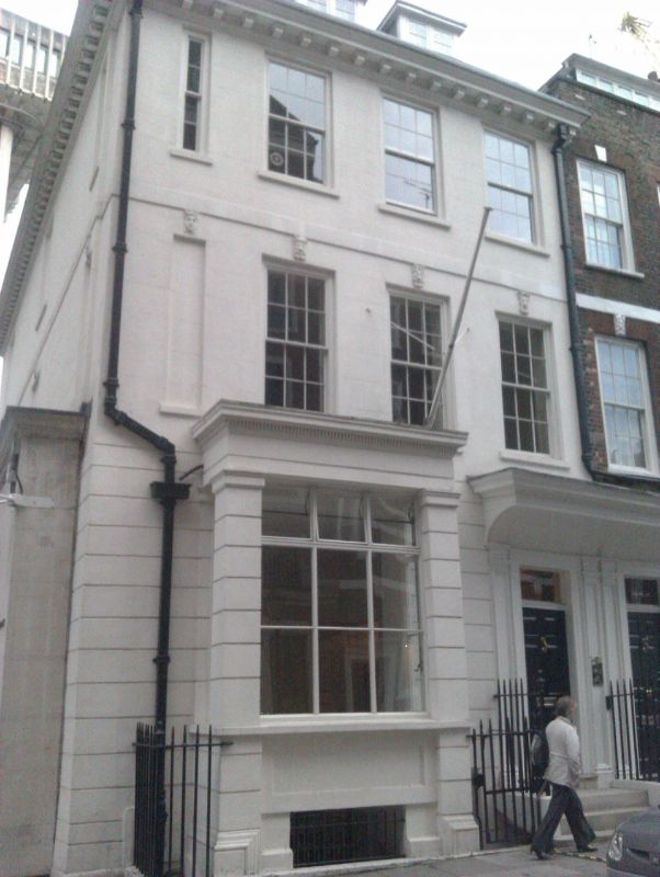
Entry Name: 46, Queen Anne's Gate SW1
Listing Date: 24 February 1958
Grade: I
Source: Historic England
Source ID: 1265430
English Heritage Legacy ID: 425059
ID on this website: 101265430
Location: Westminster, London, SW1H
County: London
District: City of Westminster
Electoral Ward/Division: St James's
Parish: Non Civil Parish
Built-Up Area: City of Westminster
Traditional County: Middlesex
Lieutenancy Area (Ceremonial County): Greater London
Church of England Parish: St Peter Eaton Square
Church of England Diocese: London
Tagged with: Building
CITY OF WESTMINSTER QUEEN ANNE'S GATE, SWl TQ 2979 NE 91/34 24.2.58 No 46 G.V. I Terraced town house. c1700-1704, with early C19 alteration, built as part of the original Queen Square development, probably as a pair with No 44, q.v. Stucco faced brown brick, slate roof. 3 storeys, basement and dormered attic. 3 windows wide plus a half blind window. Entrance to right (coupled with No 44) has panelled door in wood architrave case with projecting cove hood. Slightly recessed framed bay window built over area to ground floor. 1st and 2nd floor plat bands. Wood modillion eaves cornice. Rear elevation stuccoed but retaining mask keystones, plat bands etc. Interior retains considerable amount of panelling and cornices, and cut and carved string staircase with 3 twisted balusters per tread, etc. Part of an exceptional group of Queen Anne houses. Survey of London; Vol X [R C H M]
Listing NGR: TQ2959779577
External links are from the relevant listing authority and, where applicable, Wikidata. Wikidata IDs may be related buildings as well as this specific building. If you want to add or update a link, you will need to do so by editing the Wikidata entry.


Other nearby listed buildings