Latitude: 51.5004 / 51°30'1"N
Longitude: -0.1337 / 0°8'1"W
OS Eastings: 529636
OS Northings: 179586
OS Grid: TQ296795
Mapcode National: GBR GJ.4B
Mapcode Global: VHGQZ.MKN5
Plus Code: 9C3XGV28+4G
Entry Name: 25, Queen Anne's Gate SW1
Listing Date: 24 February 1958
Grade: I
Source: Historic England
Source ID: 1265450
English Heritage Legacy ID: 425002
ID on this website: 101265450
Location: Westminster, London, SW1H
County: London
District: City of Westminster
Electoral Ward/Division: St James's
Parish: Non Civil Parish
Built-Up Area: City of Westminster
Traditional County: Middlesex
Lieutenancy Area (Ceremonial County): Greater London
Church of England Parish: St Matthew Westminster
Church of England Diocese: London
Tagged with: Building
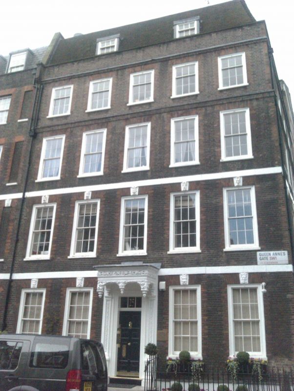
TQ 2979 NE CITY OF WESTMINSTER QUEEN ANNE'S GATE, SWl 91/31 24.2.58 No 25 G.V. I Corner terraced town house. c1700-04, as part of the original Queen Square development, but heightened late C18/early C19 and with early C20 alteration of interior. Brown brick with red brick dressings up to 2nd floor, slate roof. 4 storeys and basement. 5 windows wide. Central entrance,approached by steps, retains original carved wood doorcase with panelled enriched pilasters and remarkable canopy cornice-hood with pediment finials, carved overall with foliage enrichment. Flush framed glazing bar sashes, under flat gauged red brick arches up to 2nd floor, recessed above; carved mask keystones on ground and 1st floors and stone plat bands over them. Parapet with coping. Wrought iron area railings with flambé torch finials. Interior radically altered early to mid C20, with panelled neo-Georgian staircase etc. Part of an exceptional group of Queen Anne houses. Survey of London; Vol X R C H M
Listing NGR: TQ2964079584
External links are from the relevant listing authority and, where applicable, Wikidata. Wikidata IDs may be related buildings as well as this specific building. If you want to add or update a link, you will need to do so by editing the Wikidata entry.


Other nearby listed buildings