Approximate Location Map
Large Map »
Latitude: 51.2756 / 51°16'32"N
Longitude: 0.527 / 0°31'37"E
OS Eastings: 576354
OS Northings: 155969
OS Grid: TQ763559
Mapcode National: GBR PR1.VDP
Mapcode Global: VHJMF.26YH
Plus Code: 9F327GGG+6Q
Entry Name: 34-36, Wyatt Street
Listing Date: 2 August 1974
Grade: II
Source: Historic England
Source ID: 1266234
English Heritage Legacy ID: 422171
ID on this website: 101266234
Location: Maidstone, Kent, ME14
County: Kent
District: Maidstone
Electoral Ward/Division: High Street
Parish: Non Civil Parish
Built-Up Area: Maidstone
Traditional County: Kent
Lieutenancy Area (Ceremonial County): Kent
Tagged with: Building
WYATT STREET
1.
5278
(West Side)
Nos 34 to 36 (consec)
TQ 7655 NW 2/381
II GV
2.
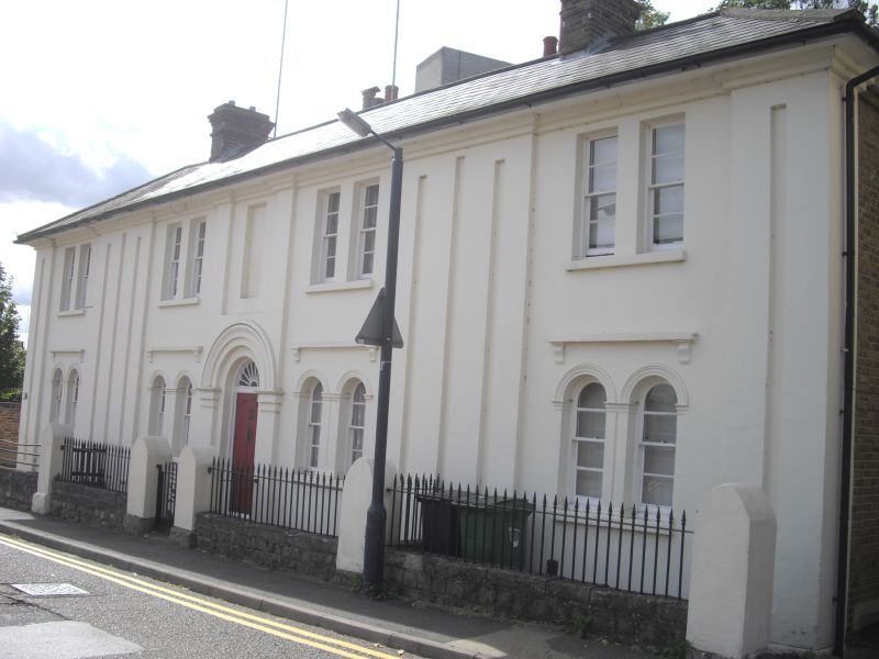
Mid C19. 2 storeys stuccoed. Hipped slate roof. 4 double sashes. 14 pilasters
in all. Simple round-headed central doorcase with semi-circular fanlight.
Side doorcases to nos 34 and 36 with cornices and scrolled brackets.
Nos 29 to 36 (consec) form a group.
Listing NGR: TQ7635055975
External links are from the relevant listing authority and, where applicable, Wikidata. Wikidata IDs may be related buildings as well as this specific building. If you want to add or update a link, you will need to do so by editing the Wikidata entry.


Other nearby listed buildings
