Latitude: 50.7123 / 50°42'44"N
Longitude: -1.9873 / 1°59'14"W
OS Eastings: 400992
OS Northings: 90292
OS Grid: SZ009902
Mapcode National: GBR XQB.N6
Mapcode Global: FRA 67Q6.9M4
Plus Code: 9C2WP267+W3
Entry Name: Portsmouth Hoy Public House
Listing Date: 28 May 1974
Grade: II
Source: Historic England
Source ID: 1266376
English Heritage Legacy ID: 412630
Also known as: The Portsmouth Hoy, Poole
Portsmouth Hoy
ID on this website: 101266376
Location: Old Town, Bournemouth, Christchurch and Poole, Dorset, BH15
County: Bournemouth, Christchurch and Poole
Parish: Non Civil Parish
Built-Up Area: Poole
Traditional County: Dorset
Lieutenancy Area (Ceremonial County): Dorset
Church of England Parish: Poole St James with St Paul
Church of England Diocese: Salisbury
Tagged with: Pub
POOLE
SZ0090SE THE QUAY 958-1/17/191 (North side) 28/05/74 Portsmouth Hoy Public House
GV II
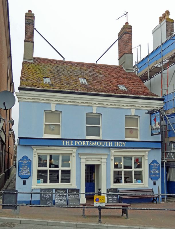
Public house. Late C18, altered mid C19. Stucco with tall gable stacks braced with iron from the ridge, tiled roof with stone slate verges. Single-depth plan with rear wing at right angles. 2 storeys and attic; 3-window range. Double-fronted with bracketed moulded eaves cornice returned at the ends, original doorway with panelled jambs and cornice, mid C19 ground-floor windows with flat architraves and bracketed cornices to late C20 glazing, and horned first-floor plate-glass sashes. INTERIOR altered on the ground floor, recorded as having an attic stair with late C18 balusters. (RCHME: County of Dorset (South East): London: 1970-: 233).
Listing NGR: SZ0099290292
External links are from the relevant listing authority and, where applicable, Wikidata. Wikidata IDs may be related buildings as well as this specific building. If you want to add or update a link, you will need to do so by editing the Wikidata entry.


Other nearby listed buildings