Approximate Location Map
Large Map »
Latitude: 51.3409 / 51°20'27"N
Longitude: 1.2713 / 1°16'16"E
OS Eastings: 627937
OS Northings: 165279
OS Grid: TR279652
Mapcode National: GBR VYW.XXY
Mapcode Global: VHLGB.ZKGG
Plus Code: 9F3387RC+8G
Entry Name: Stocks, About 30 Metres North West of Church of Saint Mary
Listing Date: 11 October 1963
Grade: II
Source: Historic England
Source ID: 1266637
English Heritage Legacy ID: 420936
ID on this website: 101266637
Location: Monkton, Thanet, Kent, CT12
County: Kent
District: Thanet
Civil Parish: Monkton
Built-Up Area: Monkton
Traditional County: Kent
Lieutenancy Area (Ceremonial County): Kent
Tagged with: Stocks
MONKTON MONKTON STREET
TR 26 NE
(South side)
1/70
Stocks, about 30
11-10-63 metres north west
of Church of
St. Mary
GV II
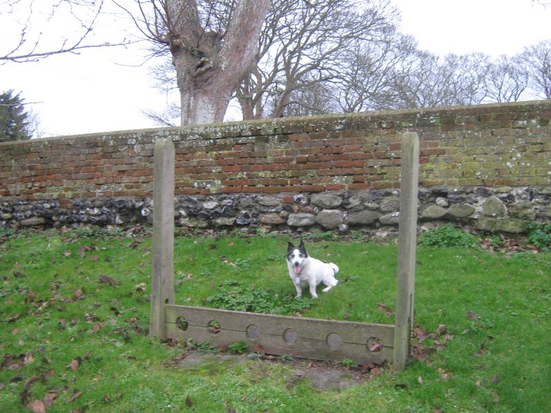
Stocks. C18. Wooden posts and stock boards. Posts braced at ground
level, foot boards with 6 foot-holes. Upper board lifts at right end
only, secured by iron chains.
Listing NGR: TR2845965170
External links are from the relevant listing authority and, where applicable, Wikidata. Wikidata IDs may be related buildings as well as this specific building. If you want to add or update a link, you will need to do so by editing the Wikidata entry.


Other nearby listed buildings
