Latitude: 51.3403 / 51°20'25"N
Longitude: 1.271 / 1°16'15"E
OS Eastings: 627916
OS Northings: 165219
OS Grid: TR279652
Mapcode National: GBR VYW.XVK
Mapcode Global: VHLGB.ZK8V
Plus Code: 9F3387RC+49
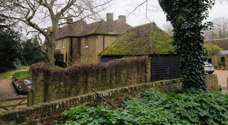
Entry Name: Granary About 3 Metres North of Monkton Court
Listing Date: 7 October 1986
Grade: II
Source: Historic England
Source ID: 1266638
English Heritage Legacy ID: 420938
ID on this website: 101266638
Location: Gore Street, Thanet, Kent, CT12
County: Kent
District: Thanet
Civil Parish: Monkton
Built-Up Area: Monkton
Traditional County: Kent
Lieutenancy Area (Ceremonial County): Kent
Tagged with: Granary
MONKTON MONKTON STREET TR 26 NE (South side) 1/72 Granary about 3 metres north of Monkton Court GV II Granary, now outhouse. C16. Timber framed and weather boarded on red brick base. Plain tiled roof. Hipped roof with gablets. Interior: 2 framed bays with central tie beam on jowled posts with arched bracing to tie, and arched bracing from corner posts to wall plate. Clasped purlin roof. Possibly reconstructed from C15 domestic timbers.
Listing NGR: TR2897164979
External links are from the relevant listing authority and, where applicable, Wikidata. Wikidata IDs may be related buildings as well as this specific building. If you want to add or update a link, you will need to do so by editing the Wikidata entry.


Other nearby listed buildings