Approximate Location Map
Large Map »
Latitude: 51.4985 / 51°29'54"N
Longitude: -0.201 / 0°12'3"W
OS Eastings: 524970
OS Northings: 179260
OS Grid: TQ249792
Mapcode National: GBR C9.80M
Mapcode Global: VHGQY.GLLM
Plus Code: 9C3XFQXX+9H
Entry Name: Letter Box Outside Numbers 276-280
Listing Date: 7 November 1984
Grade: II
Source: Historic England
Source ID: 1267134
English Heritage Legacy ID: 419636
ID on this website: 101267134
Location: Kensington, Kensington and Chelsea, London, W14
County: London
District: Kensington and Chelsea
Electoral Ward/Division: Holland
Parish: Non Civil Parish
Built-Up Area: Kensington and Chelsea
Traditional County: Middlesex
Lieutenancy Area (Ceremonial County): Greater London
Church of England Parish: St Barnabas Addison Road
Church of England Diocese: London
Tagged with: Post box
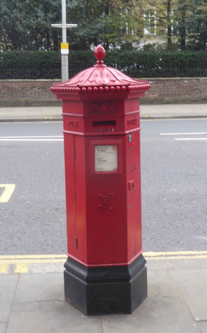
TQ 2479 SE KENSINGTON HIGH STREET W14
35/22
Letter Box outside Nos
276-280
II
Hexagonal letter box. Probably mid-C19. Metal. Penfold pattern.
Listing NGR: TQ2497079260
External links are from the relevant listing authority and, where applicable, Wikidata. Wikidata IDs may be related buildings as well as this specific building. If you want to add or update a link, you will need to do so by editing the Wikidata entry.


Other nearby listed buildings
