Latitude: 51.5811 / 51°34'51"N
Longitude: -2.0955 / 2°5'43"W
OS Eastings: 393480
OS Northings: 186919
OS Grid: ST934869
Mapcode National: GBR 2QZ.YV2
Mapcode Global: VH95S.MJK9
Plus Code: 9C3VHWJ3+CR
Entry Name: 133, High Street
Listing Date: 6 August 1974
Last Amended: 19 July 1996
Grade: II
Source: Historic England
Source ID: 1269329
English Heritage Legacy ID: 460867
ID on this website: 101269329
Location: Burton Hill, Wiltshire, SN16
County: Wiltshire
Civil Parish: Malmesbury
Built-Up Area: Malmesbury
Traditional County: Wiltshire
Lieutenancy Area (Ceremonial County): Wiltshire
Church of England Parish: Malmesbury and Brokenborough
Church of England Diocese: Bristol
Tagged with: Building
MALMESBURY
ST9386 HIGH STREET 758-1/3/204 (South side) 06/08/74 No.133 (Formerly Listed as: HIGH STREET (South side) Nos.87-103, 107, 113-137 (Odd))
GV II
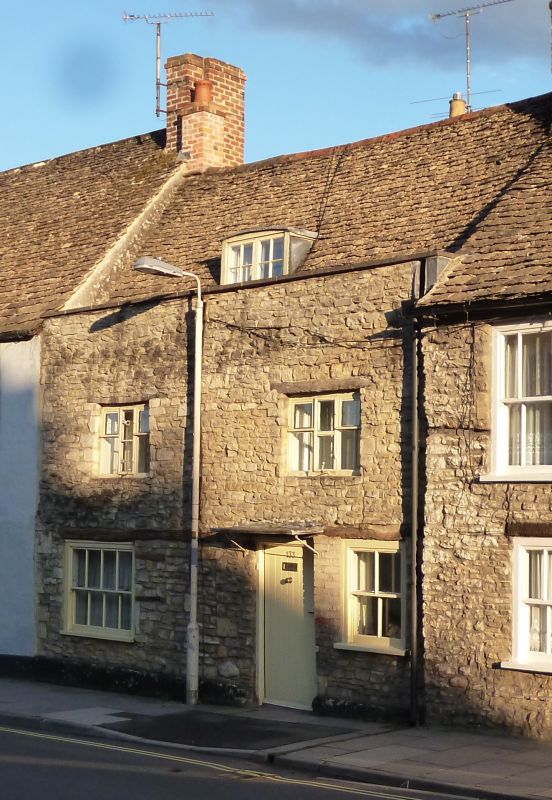
House and inn, now one house. Early C17, refronted and extended to rear mid C18. Limestone rubble, formerly roughcast, brick left-hand gable and rear lateral stacks, and stone slate roof. Single-depth plan with rear gabled ranges. EXTERIOR: 2 storeys and attic; 2-window range. A parapeted front with timber lintels, on the ground-floor extending across central doorways, the left-hand one blocked, the right-hand one with a boarded door; outer windows, the left-hand one a C20 casement, the right-hand one a 2/2-pane horned sash, and altered C18 first-floor 3-light casements with stays; single C20 dormer. Quoins to left-hand end to beneath parapet, and full-width plinth crossing blocked doorway. Rear ranges, to the E with C20 casements and a small gable loop, and a long W range with a steep roof pitch. INTERIOR: details include a left-hand rear C17 fireplace with splayed reveals, chamfered, cambered bressumer, and a tall curved left-hand niche, with a covered left-hand end fireplace; chamfered ceiling beams, first-floor left-hand end fireplace; roof with collar trusses, one in each end gable, the left-hand one with a cambered collar, and rear left-hand range above partly truncated stack. HISTORICAL NOTE: trusses in each end and fireplace set to the left end suggest a previously longer extent to the original C17 building.
Listing NGR: ST9348186917
External links are from the relevant listing authority and, where applicable, Wikidata. Wikidata IDs may be related buildings as well as this specific building. If you want to add or update a link, you will need to do so by editing the Wikidata entry.


Other nearby listed buildings