Latitude: 51.5825 / 51°34'56"N
Longitude: -2.0978 / 2°5'52"W
OS Eastings: 393320
OS Northings: 187075
OS Grid: ST933870
Mapcode National: GBR 2QZ.QG0
Mapcode Global: VH95S.LHB6
Plus Code: 9C3VHWJ2+XV
Entry Name: 39, High Street
Listing Date: 18 January 1949
Last Amended: 19 July 1996
Grade: II
Source: Historic England
Source ID: 1269408
English Heritage Legacy ID: 460820
ID on this website: 101269408
Location: Malmesbury, Wiltshire, SN16
County: Wiltshire
Civil Parish: Malmesbury
Built-Up Area: Malmesbury
Traditional County: Wiltshire
Lieutenancy Area (Ceremonial County): Wiltshire
Church of England Parish: Malmesbury and Brokenborough
Church of England Diocese: Bristol
Tagged with: Building
MALMESBURY
ST9387 HIGH STREET 758-1/4/156 (West side) 18/01/49 No.39 (Formerly Listed as: HIGH STREET (West side) Nos.37 AND 39)
GV II
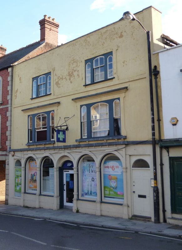
Pair of houses, now 1 shop with flats above. 1487 [tree-ring dating]; remodelled C18 and C19. Rendered timber-frame; limestone rubble rear wing. 2-span stone tile roof, formerly with two gables at front, now hipped behind parapet. PLAN:Originally two 1-bay 3-storey double-jettied timber-framed houses; remodelled in the C18 and C19 and a shop formed on the ground floor with an entrance on the right to accommodation above. Later stone rear wing. EXTERIOR: 3 storeys; 2-window range. Symmetrical front has thin pilaster strips and storey bands below the parapet, with a ground-floor arcade of 5 round-headed arches with a central doorway and bracketed cornice and imposts, a right-hand doorway with 6-panel door and plate-glass fanlight, and matching left-hand window. First-floor tripartite windows have segmental-arched central heads in raised frames with cornices, and similar smaller second-floor windows in raised surrounds, with 2-light plate-glass sashes. Roof has 2 hips behind the parapet, possibly formerly a pair of street gables, which extend back to rear gables. Rear elevation has a 2-storey gabled wing projecting back with a 3-light C17 casement mullion window with leaded metal casements. INTERIOR: Exposed timber-framing, including jowled storey-posts, some exposed wall-framing at the sides with wall-plates and one curved brace. Collar and tie-beam roof trusses with chamfered tie-beams, trenched purlins and wind-braces. There is no exposed timber-framing on the ground floor except for a re-set moulded timber in the entrance passage on the right. Restored circa early C18 newel staircase with closed string, square newels, turned balusters and a heavy handrail. A rare example of a late C15 town house. SOURCES: [1] Cotswold Archaeology, report 03070 [2] Miles, W.H. Oxford Dendrochronology Laboratory: The Tree-Ring Dating of Saxon House, 39 High Street, Malmesbury.
Listing NGR: ST9331587073
External links are from the relevant listing authority and, where applicable, Wikidata. Wikidata IDs may be related buildings as well as this specific building. If you want to add or update a link, you will need to do so by editing the Wikidata entry.


Other nearby listed buildings