Latitude: 51.5871 / 51°35'13"N
Longitude: -2.1016 / 2°6'5"W
OS Eastings: 393060
OS Northings: 187588
OS Grid: ST930875
Mapcode National: GBR 2QZ.HHP
Mapcode Global: VH95S.JCCN
Plus Code: 9C3VHVPX+R9
Entry Name: Westport House
Listing Date: 1 July 1976
Grade: II
Source: Historic England
Source ID: 1269442
English Heritage Legacy ID: 460770
ID on this website: 101269442
Location: Malmesbury, Wiltshire, SN16
County: Wiltshire
Civil Parish: Malmesbury
Built-Up Area: Malmesbury
Traditional County: Wiltshire
Lieutenancy Area (Ceremonial County): Wiltshire
Church of England Parish: Malmesbury and Brokenborough
Church of England Diocese: Bristol
Tagged with: House
MALMESBURY
ST9387 GLOUCESTER ROAD 758-1/2/107 (West side) 01/07/76 No.116 Westport House
GV II
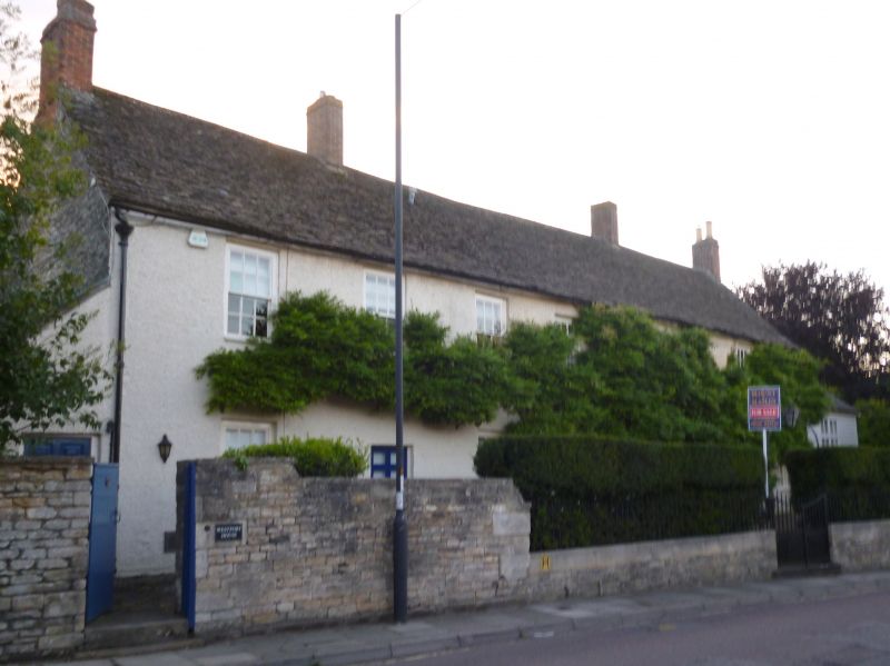
House. Late C16, altered and extended to either end in mid C18, library added mid C19. Rendered over limestone rubble with overlapping boarding to library, brick gable and axial stacks and stone slate roof. PLAN: single-depth, now with rear extension. EXTERIOR: 2 storeys and attic; 2:3:2-window range. A central 3-window C16 house with a right-hand door, C18 extensions each end with a right-hand doorway to the left-hand section, with 6/6-pane sashes in exposed boxes; French windows to single-storey early C20 addition (former studio) attached to right-hand end. INTERIOR: details include steep collared trusses from an earlier roof, extended C18, a good C16 unglazed oak window in the former rear wall, now an internal opening, with diamond mullions, a good early C18 panelled ground-floor room with egg and dart moulding, winder stair to the attic, and C18 rear stair flight; the former studio has segmental-vaulted timber ceiling and panelled walls.
Listing NGR: ST9306087588
External links are from the relevant listing authority and, where applicable, Wikidata. Wikidata IDs may be related buildings as well as this specific building. If you want to add or update a link, you will need to do so by editing the Wikidata entry.


Other nearby listed buildings