Latitude: 50.1562 / 50°9'22"N
Longitude: -5.0721 / 5°4'19"W
OS Eastings: 180652
OS Northings: 32979
OS Grid: SW806329
Mapcode National: GBR ZD.T8TQ
Mapcode Global: FRA 088L.V3B
Plus Code: 9C2P5W4H+F5
Entry Name: Women's Institute
Listing Date: 23 January 1973
Grade: II
Source: Historic England
Source ID: 1269951
English Heritage Legacy ID: 460242
ID on this website: 101269951
Location: Falmouth, Cornwall, TR11
County: Cornwall
Civil Parish: Falmouth
Built-Up Area: Falmouth
Traditional County: Cornwall
Lieutenancy Area (Ceremonial County): Cornwall
Church of England Parish: Falmouth All Saints
Church of England Diocese: Truro
Tagged with: Architectural structure
FALMOUTH
SW8032NE WEBBER STREET 843-1/7/221 No.14 23/01/73 Women's Institute
GV II
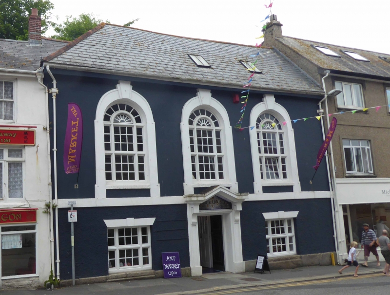
Town house, now an institute. Mid C18, remodelled possibly 1918. Stucco on rubble with mid-floor band, moulded architraves and stepped keyblocks to large 1st-floor round-arched windows; steep asbestos slate roof with projecting eaves, hipped on the left. Double-depth plan. 2 storeys with tall 1st floor; symmetrical 3-window front. 1930s tripartite transomed wooden mullioned windows with glazing bars; double transoms and concentric spoked fanlight heads to 1st floor. Central pilastered doorway with open pediment on consoles framing name. INTERIOR: retains good quality C18 open-well staircase with turned balusters, moulded closed string and square newel posts with caps, also carved consoles flanking entrance to stair hall and flanking stairs.
Listing NGR: SW8065232979
External links are from the relevant listing authority and, where applicable, Wikidata. Wikidata IDs may be related buildings as well as this specific building. If you want to add or update a link, you will need to do so by editing the Wikidata entry.


Other nearby listed buildings