Approximate Location Map
Large Map »
Latitude: 50.1549 / 50°9'17"N
Longitude: -5.0724 / 5°4'20"W
OS Eastings: 180626
OS Northings: 32835
OS Grid: SW806328
Mapcode National: GBR ZD.T8RZ
Mapcode Global: FRA 088M.1NY
Plus Code: 9C2P5W3H+X2
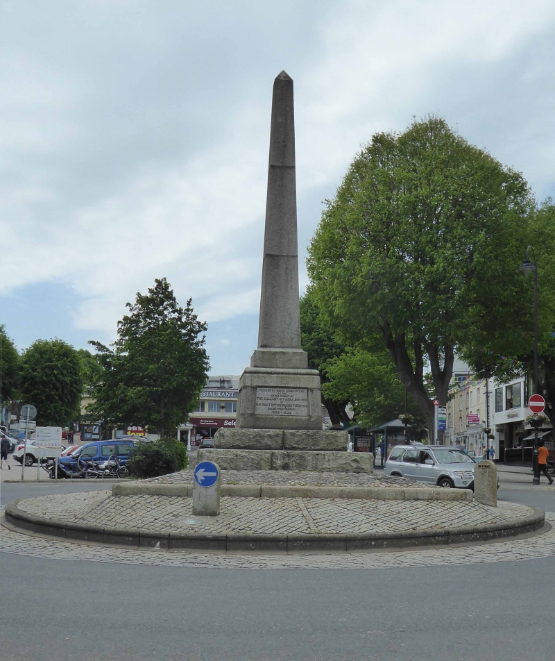
Entry Name: The Packet Monument
Listing Date: 16 April 1975
Grade: II
Source: Historic England
Source ID: 1269982
English Heritage Legacy ID: 460231
ID on this website: 101269982
Location: Falmouth, Cornwall, TR11
County: Cornwall
Civil Parish: Falmouth
Built-Up Area: Falmouth
Traditional County: Cornwall
Lieutenancy Area (Ceremonial County): Cornwall
Church of England Parish: Falmouth King Charles the Martyr
Church of England Diocese: Truro
Tagged with: Monument
FALMOUTH
SW8032NE THE MOOR
843-1/7/206 The Packet Monument
16/04/75
GV II
Monument. 1898 by public subscription "To the Memory of the
Gallant Officers and Men of H M Post Office and Packet Service
sailing from Falmouth 1688-1852." (Inscription). Granite
obelisk, in 3 sections, on panelled pedestal on stepped
rock-faced granite base within granite kerb.
Listing NGR: SW8062632835
External links are from the relevant listing authority and, where applicable, Wikidata. Wikidata IDs may be related buildings as well as this specific building. If you want to add or update a link, you will need to do so by editing the Wikidata entry.


Other nearby listed buildings
