Latitude: 50.1572 / 50°9'26"N
Longitude: -5.0721 / 5°4'19"W
OS Eastings: 180656
OS Northings: 33093
OS Grid: SW806330
Mapcode National: GBR ZD.T8TC
Mapcode Global: FRA 088L.V2W
Plus Code: 9C2P5W4H+V4
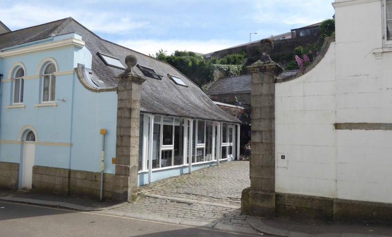
Entry Name: Gateway and Street Frontage Walls of Former Stables at Carn's Yard
Listing Date: 16 April 1975
Last Amended: 24 April 1996
Grade: II
Source: Historic England
Source ID: 1270040
English Heritage Legacy ID: 460162
ID on this website: 101270040
Location: Falmouth, Cornwall, TR11
County: Cornwall
Civil Parish: Falmouth
Built-Up Area: Falmouth
Traditional County: Cornwall
Lieutenancy Area (Ceremonial County): Cornwall
Church of England Parish: Falmouth All Saints
Church of England Diocese: Truro
Tagged with: Gate
FALMOUTH
SW8033SE HIGH STREET 843-1/5/123 (South West side) 16/04/75 Gateway and street frontage walls of former stables at Carn's Yard (Formerly Listed as: HIGH STREET (South West side) Stables at Carn's Yard (gateway and end walls facing High Street only))
GV II
Street frontage walls, screen walls and gate piers to gateway of former stable yard of brewery. Mid C19. Stucco on rubble with granite ashlar plinth and ramped copings to pair of granite ashlar gate piers with moulded cornices, pyramidal caps and ball finials; moulded stucco impost strings and round arches; sill brackets. 2 storeys; symmetrical 4-window elevation with central gateway. Ground floor has doorway central under each pair of windows. C20 plain fanlights over casement windows and C20 doors. Stables converted into shops and not included. The street frontage forms a prominent feature in this part of Falmouth. Included for group value.
Listing NGR: SW8065633093
External links are from the relevant listing authority and, where applicable, Wikidata. Wikidata IDs may be related buildings as well as this specific building. If you want to add or update a link, you will need to do so by editing the Wikidata entry.


Other nearby listed buildings