Latitude: 50.1536 / 50°9'12"N
Longitude: -5.0682 / 5°4'5"W
OS Eastings: 180918
OS Northings: 32676
OS Grid: SW809326
Mapcode National: GBR ZD.THVN
Mapcode Global: FRA 088M.3BK
Plus Code: 9C2P5W3J+CP
Entry Name: 26, Church Street
Listing Date: 24 April 1996
Grade: II
Source: Historic England
Source ID: 1270108
English Heritage Legacy ID: 460103
ID on this website: 101270108
Location: Falmouth, Cornwall, TR11
County: Cornwall
Civil Parish: Falmouth
Built-Up Area: Falmouth
Traditional County: Cornwall
Lieutenancy Area (Ceremonial County): Cornwall
Church of England Parish: Falmouth King Charles the Martyr
Church of England Diocese: Truro
Tagged with: Building
FALMOUTH
SW8032NE CHURCH STREET 843-1/7/56 (West side) No.26
GV II
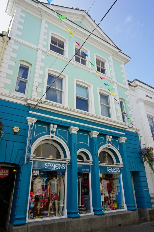
Former general post office, now a shop. C18 core; extended, refronted and remodelled 1867 at a cost of »1,300, paid for by 20 local businessmen. Stucco on masonry with asbestos slate roof. Deep plan. Classical style. 3 storeys; symmetrical 1:3:1-bay front with flanking windows to 1st floor only, over low ope (passage) doorways. Rusticated quoins, moulded architraves, 2nd-floor sills on brackets to moulded string and heavy moulded parapet cornice linked to triangular pediment over centre bays broken forward; granite plinth. Original horned sashes. Ground-floor centre has 3 round arches (windows flanking lower central doorway) within Tuscan colonnade with consoles as keyblocks to windows under moulded entablature. Possibly original glazed door at far left, the other door C20. INTERIOR not inspected. HISTORY: following a period of inadequate accommodation and inefficiency local businessmen each bought between one and 5 shares to a total of 40, each worth »50. The resulting purpose-built premises made it easier to handle the newly-introduced (1869) electric telegraph as the Falmouth office dealt with overseas calls. This was Falmouth's post office until the present one was built on The Moor in 1929. (Gilson P: Falmouth in Old Photographs: Falmouth: 1990-: 53; Kelly: Kelly's Directory for Cornwall: London: 1910-: 105).
Listing NGR: SW8091832676
External links are from the relevant listing authority and, where applicable, Wikidata. Wikidata IDs may be related buildings as well as this specific building. If you want to add or update a link, you will need to do so by editing the Wikidata entry.


Other nearby listed buildings