Latitude: 53.3018 / 53°18'6"N
Longitude: -1.4684 / 1°28'6"W
OS Eastings: 435523
OS Northings: 378451
OS Grid: SK355784
Mapcode National: GBR LZ58.W3
Mapcode Global: WHDF2.D8ZL
Plus Code: 9C5W8G2J+PJ
Entry Name: Outbuilding to the South East of Chiverton House
Listing Date: 7 July 1989
Grade: II
Source: Historic England
Source ID: 1270290
English Heritage Legacy ID: 459790
ID on this website: 101270290
Location: Dronfield, North East Derbyshire, S18
County: Derbyshire
District: North East Derbyshire
Civil Parish: Dronfield
Built-Up Area: Dronfield
Traditional County: Derbyshire
Lieutenancy Area (Ceremonial County): Derbyshire
Church of England Parish: Dronfield St John Baptist
Church of England Diocese: Derby
Tagged with: Appendage
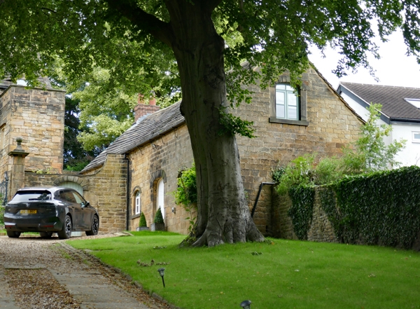
PARISH OF DRONFIELD CHESTERFIELD ROAD SK 37 NE 6/21 Outbuilding to the south-east of Chiverton House II GV Outbuilding, formerly stables and brewhouse. c1712, with early C19 remodelling. Regularly coursed squared coal measures sandstone with quoins, a brick north gable stack, and a stone slated roof. Single storey with overlofts, three bays, the west elevation being interrupted by the boundary wall to the front of Chiverton House which terminates between the first and second bays. Southern two bays with window openings with channelled three centred arched heads and flush stone frames. Louvred windows with radiating glazing bars to heads. Central doorway with quoined surround and three centred arched head. Plain door. Overloft door to south gable apex. A further doorway and taking-in door are obscured by boundary wall.
Listing NGR: SK3552378451
External links are from the relevant listing authority and, where applicable, Wikidata. Wikidata IDs may be related buildings as well as this specific building. If you want to add or update a link, you will need to do so by editing the Wikidata entry.


Other nearby listed buildings