Latitude: 52.7082 / 52°42'29"N
Longitude: -2.7541 / 2°45'14"W
OS Eastings: 349144
OS Northings: 312548
OS Grid: SJ491125
Mapcode National: GBR BJ.2GN3
Mapcode Global: WH8BT.N6Q5
Plus Code: 9C4VP65W+78
Entry Name: 26 and 27, High Street
Listing Date: 19 September 1972
Grade: II
Source: Historic England
Source ID: 1270761
English Heritage Legacy ID: 457328
ID on this website: 101270761
Location: Shrewsbury, Shropshire, SY1
County: Shropshire
Civil Parish: Shrewsbury
Built-Up Area: Shrewsbury
Traditional County: Shropshire
Lieutenancy Area (Ceremonial County): Shropshire
Church of England Parish: Shrewsbury St Alkmund
Church of England Diocese: Lichfield
Tagged with: Building
SHREWSBURY
SJ4912NW HIGH STREET 653-1/11/355 (North East side) 19/09/72 Nos.26 AND 27
II
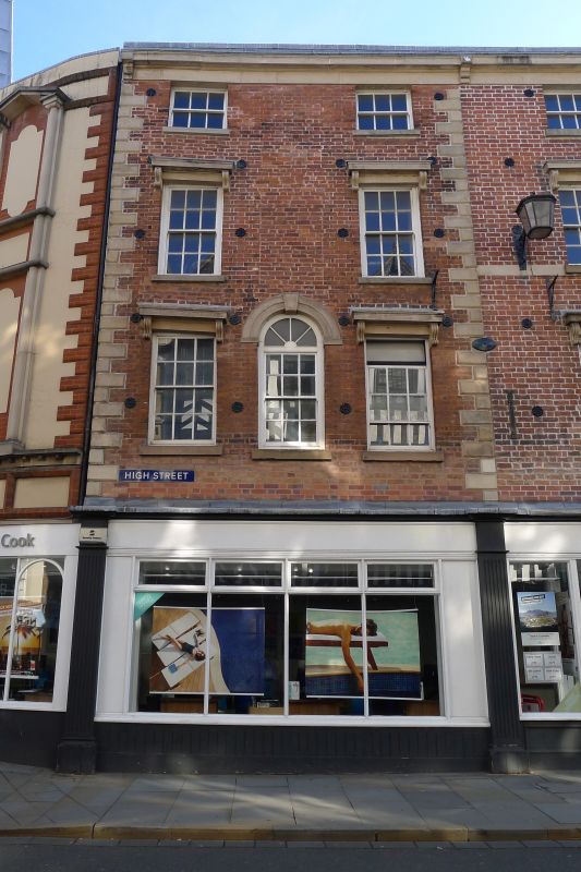
2 buildings, now shop, but probably originally dwellings. c1800. Brick with roof not visible behind parapet. 4 storeys, 5-window range, divided 3-2 between the 2 buildings which are separate constructions though built at the same time. Late C20 inserted shopfront continues across adjacent property, No.25 (qv). Upper windows are 12-pane sashes with flat entablatures over, carried on moulded console brackets. There is an additional window in the centre of the first floor of No.27, with round-arched head. Stone quoins on angles of No.27. Moulded stone eaves cornice of identical design to both properties. Both form part of department store, and have done so since at least the early C20.
Listing NGR: SJ4914412548
External links are from the relevant listing authority and, where applicable, Wikidata. Wikidata IDs may be related buildings as well as this specific building. If you want to add or update a link, you will need to do so by editing the Wikidata entry.


Other nearby listed buildings