Latitude: 52.7079 / 52°42'28"N
Longitude: -2.7575 / 2°45'27"W
OS Eastings: 348914
OS Northings: 312514
OS Grid: SJ489125
Mapcode National: GBR BJ.2FSM
Mapcode Global: WH8BT.M63D
Plus Code: 9C4VP65R+4X
Entry Name: 25 and 26, Claremont Hill
Listing Date: 10 January 1953
Last Amended: 17 November 1995
Grade: II
Source: Historic England
Source ID: 1271078
English Heritage Legacy ID: 456145
ID on this website: 101271078
Location: Shrewsbury, Shropshire, SY1
County: Shropshire
Civil Parish: Shrewsbury
Built-Up Area: Shrewsbury
Traditional County: Shropshire
Lieutenancy Area (Ceremonial County): Shropshire
Church of England Parish: Shrewsbury St Chad
Church of England Diocese: Lichfield
Tagged with: Building
SHREWSBURY
SJ4812NE CLAREMONT HILL 653-1/10/204 (North side) 10/01/53 Nos.25 AND 26 (Formerly Listed as: CLAREMONT HILL (North side) No.25) (Formerly Listed as: CLAREMONT HILL (North side) No.26)
GV II
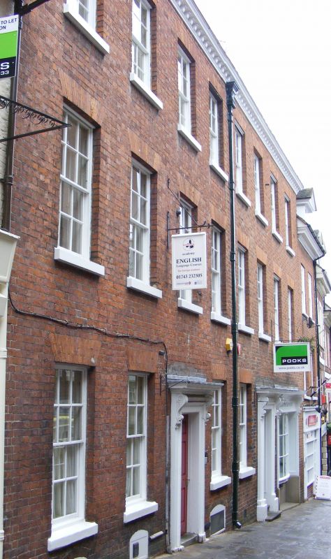
Pair of houses, now in use as shops and offices. Brick with plain tiled roof. 3-storeyed, each a 4-window range. Doorway flanked by 2 sash windows on each side to left, inserted shop front to right, with fascia and console brackets. Flat-arched gauged brick heads to sash windows. Moulded modillion eaves cornice and parapet with dormer windows to attic behind. End wall stacks. Central rainwater head dated 1764. Each unit has original staircase inside, with 3 turned balusters to each tread and scrolled tread ends.
Listing NGR: SJ4891412514
External links are from the relevant listing authority and, where applicable, Wikidata. Wikidata IDs may be related buildings as well as this specific building. If you want to add or update a link, you will need to do so by editing the Wikidata entry.


Other nearby listed buildings