Latitude: 51.8595 / 51°51'34"N
Longitude: -2.2547 / 2°15'16"W
OS Eastings: 382555
OS Northings: 217913
OS Grid: SO825179
Mapcode National: GBR 1L5.6T5
Mapcode Global: VH94B.VJWB
Plus Code: 9C3VVP5W+R4
Entry Name: Iron Framed Shed to South of Downings Malthouse
Listing Date: 15 December 1998
Grade: II
Source: Historic England
Source ID: 1271709
English Heritage Legacy ID: 472347
ID on this website: 101271709
Location: High Orchard, Gloucester, Gloucestershire, GL2
County: Gloucestershire
District: Gloucester
Electoral Ward/Division: Westgate
Parish: Non Civil Parish
Built-Up Area: Gloucester
Traditional County: Gloucestershire
Lieutenancy Area (Ceremonial County): Gloucestershire
Church of England Parish: Hempsted with Gloucester, Saint Mary de Lode and Saint Mary de Crypt
Church of England Diocese: Gloucester
Tagged with: Warehouse Architectural structure
GLOUCESTER
SO8217 MERCHANTS' ROAD 844-1/15/198 (East side) Iron-framed shed to south of Downing's Malthouse
GV II
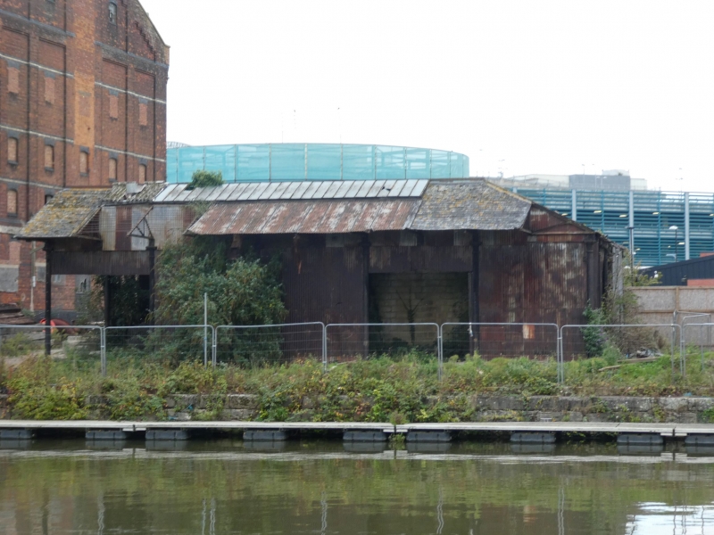
Transit shed. Built 1867 for Midland Railway Company. Iron framed clad in corrigated iorn, with hipped slate roof. Square on plan, of 4x4 bays, roofed in two parallel rectangular sections. Single storey. Roof cantilevered out towards quay. Cast-iron columns with moulded capitals; wrought-iron trusses. Built as a transit shed for the temporary storage of grain sacks prior to sending on by rail. A good and complete example both of its type and of a mid C19 iron frame. Part of an outstanding group of dock structures.
Listing NGR: SO8255517912
External links are from the relevant listing authority and, where applicable, Wikidata. Wikidata IDs may be related buildings as well as this specific building. If you want to add or update a link, you will need to do so by editing the Wikidata entry.


Other nearby listed buildings