Approximate Location Map
Large Map »
Latitude: 51.4828 / 51°28'57"N
Longitude: 0.0624 / 0°3'44"E
OS Eastings: 543303
OS Northings: 177995
OS Grid: TQ433779
Mapcode National: GBR NK.8DP
Mapcode Global: VHHNK.1ZBP
Plus Code: 9F32F3M6+4X
Entry Name: Government House
Listing Date: 6 May 1997
Grade: II
Source: Historic England
Source ID: 1271813
English Heritage Legacy ID: 468670
ID on this website: 101271813
Location: Woolwich, Greenwich, London, SE18
County: London
District: Greenwich
Electoral Ward/Division: Woolwich Common
Parish: Non Civil Parish
Built-Up Area: Greenwich
Traditional County: Kent
Lieutenancy Area (Ceremonial County): Greater London
Church of England Parish: Woolwich St Mary Magdalene with St Michael and All Angels
Church of England Diocese: Southwark
Tagged with: House
TQ 4377 WOOLWICH NEW ROAD, SE18
(East side)
786/31/10106 Government House
II
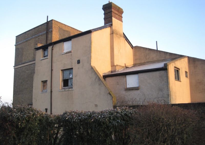
House. c1800, extended in mid C19 and renovated in 1930s. Yellow brick with stuccoed porch and string course. Roof concealed by parapet but probably slate.
EXTERIOR: 3 storeys over basement. 6-bay west front with asymmetrically placed mid C19 rusticated stucco porch and canted bay to the north. Brick parapet with moulded cornice, stuccoed band between second and first floors and plinth. Second floor retains original 6-paned sashes, other floors have mid C19 sashes with verticals only in original openings. Original main entrance survives behind the porch with decorative semi-circular fanlight and panelled reveals. 2- and 3-storey mid C19 extensions to east.
INTERIOR: c1800 oval well staircase with columnar posts, stick balusters, mahogany handrail and scrolled tread ends, a chimneypiece on the first floor incorporating red marble panels, some original doors and the service stairs.
HISTORICAL NOTE: built originally as a private house it was in military use by 1841 as the Deputy Adjutant General's residence and subsequently used as the Commandant's residence up to 1937. It is first shown on Thomas Yeakell's "Plan shewing the Ordnance Ground and parts adjacent at Woolwich" of 1810.
Listing NGR: TQ4295478475
External links are from the relevant listing authority and, where applicable, Wikidata. Wikidata IDs may be related buildings as well as this specific building. If you want to add or update a link, you will need to do so by editing the Wikidata entry.


Other nearby listed buildings
