Approximate Location Map
Large Map »
Latitude: 51.0895 / 51°5'22"N
Longitude: -0.7084 / 0°42'30"W
OS Eastings: 490556
OS Northings: 133036
OS Grid: SU905330
Mapcode National: GBR DCS.MQ5
Mapcode Global: FRA 96D7.PVX
Plus Code: 9C3X37QR+QM
Entry Name: 43, High Street
Listing Date: 19 September 1977
Grade: II
Source: Historic England
Source ID: 1272520
English Heritage Legacy ID: 448987
ID on this website: 101272520
Location: Haslemere, Waverley, Surrey, GU27
County: Surrey
District: Waverley
Civil Parish: Haslemere
Built-Up Area: Haslemere
Traditional County: Surrey
Lieutenancy Area (Ceremonial County): Surrey
Church of England Parish: Haslemere
Church of England Diocese: Guildford
Tagged with: Building
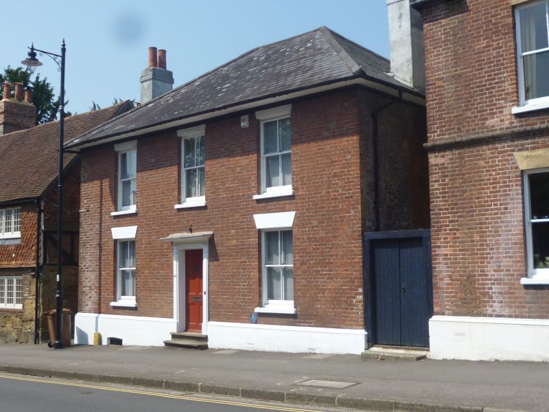
HIGH STREET
1.
5393
(West Side)
No 43
SU 9033 SE 2/85 23.1.75.
II GV
2.
Mid C19. Two storeys and sunk basement, 3 windows. Red brick villa with hipped
slate roof, eaves soffit. Sash windows, lost bars, under stuccoed lintels and
a 4-panel central door with pilasters and cornice hood. Included for group value.
Listing NGR: SU9055633036
External links are from the relevant listing authority and, where applicable, Wikidata. Wikidata IDs may be related buildings as well as this specific building. If you want to add or update a link, you will need to do so by editing the Wikidata entry.


Other nearby listed buildings
