Approximate Location Map
Large Map »
Latitude: 51.2764 / 51°16'35"N
Longitude: 0.1275 / 0°7'38"E
OS Eastings: 548486
OS Northings: 155181
OS Grid: TQ484551
Mapcode National: GBR LLJ.WKJ
Mapcode Global: VHHPR.557T
Plus Code: 9F3274GG+HX
Entry Name: Wall to South of the Manor House
Listing Date: 16 January 1975
Grade: II
Source: Historic England
Source ID: 1272634
English Heritage Legacy ID: 448045
ID on this website: 101272634
Location: Sundridge, Sevenoaks, Kent, TN14
County: Kent
District: Sevenoaks
Civil Parish: Sundridge with Ide Hill
Built-Up Area: Sundridge
Traditional County: Kent
Lieutenancy Area (Ceremonial County): Kent
Church of England Parish: Sundridge St Mary
Church of England Diocese: Rochester
Tagged with: Wall
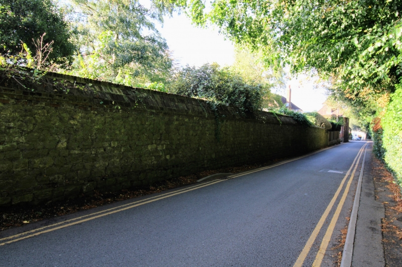
1.
5280 SUNDRIDGE SUNDRIDGE
Church Road
(West Side)
Wall to South of
The Manor House
TQ 4855 32/1251
II
2.
C18 boundary wall of coursed rubble masonry with brick coping.
Listing NGR: TQ4848455184
External links are from the relevant listing authority and, where applicable, Wikidata. Wikidata IDs may be related buildings as well as this specific building. If you want to add or update a link, you will need to do so by editing the Wikidata entry.


Other nearby listed buildings
