Approximate Location Map
Large Map »
Latitude: 51.2885 / 51°17'18"N
Longitude: 0.2207 / 0°13'14"E
OS Eastings: 554952
OS Northings: 156710
OS Grid: TQ549567
Mapcode National: GBR VT.LB8
Mapcode Global: VHHPL.SW14
Plus Code: 9F3276QC+97
Entry Name: 8, High Street
Listing Date: 10 September 1954
Grade: II
Source: Historic England
Source ID: 1272847
English Heritage Legacy ID: 447399
ID on this website: 101272847
Location: Seal, Sevenoaks, Kent, TN15
County: Kent
District: Sevenoaks
Civil Parish: Seal
Built-Up Area: Sevenoaks
Traditional County: Kent
Lieutenancy Area (Ceremonial County): Kent
Church of England Parish: Seal St Peter and St Paul
Church of England Diocese: Rochester
Tagged with: Building
1.
5280 SEAL SEAL
High Street
(South Side)
No 8
TQ 5456 NE 27/1018 10.9.54.
II
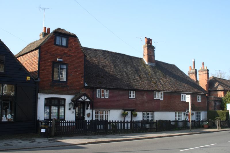
2.
C18 building of 2 storeys and attic, with half hipped gable end to road, attached
to No 6. Tiled roof and tile hung 1st floor. Red brick ground floor and rubble
plinth. Modern casements. Modern door under gabled hood on brackets.
Listing NGR: TQ5495256710
External links are from the relevant listing authority and, where applicable, Wikidata. Wikidata IDs may be related buildings as well as this specific building. If you want to add or update a link, you will need to do so by editing the Wikidata entry.


Other nearby listed buildings
