Latitude: 51.2416 / 51°14'29"N
Longitude: 0.2312 / 0°13'52"E
OS Eastings: 555837
OS Northings: 151525
OS Grid: TQ558515
Mapcode National: GBR MNK.586
Mapcode Global: VHHPZ.Y2K0
Plus Code: 9F3266RJ+JF
Entry Name: Brook Cottage
Listing Date: 10 September 1954
Grade: II
Source: Historic England
Source ID: 1272856
English Heritage Legacy ID: 447443
ID on this website: 101272856
Location: Underriver, Sevenoaks, Kent, TN15
County: Kent
District: Sevenoaks
Civil Parish: Seal
Traditional County: Kent
Lieutenancy Area (Ceremonial County): Kent
Church of England Parish: Underriver St Margaret
Church of England Diocese: Rochester
Tagged with: Cottage
1. 5280 SEAL UNDERRIVER
Brook Cottage TQ 55 SE 47/1088 10.9.54.
II
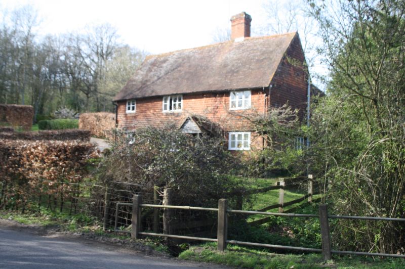
2. Probably C16. 2 storeys, 3 windows. High pitched tiled roof with old ridge stack and attic window in gable end. Roof sweep low in centre back, flanked by modern extensions. Tile hung 1st floor, brick ground floor. Modern projecting gabled porch. C19 casements. Left return shows weatherboarding above, rubble masonry below. Inside much exposed timber
Listing NGR: TQ5583751525
External links are from the relevant listing authority and, where applicable, Wikidata. Wikidata IDs may be related buildings as well as this specific building. If you want to add or update a link, you will need to do so by editing the Wikidata entry.


Other nearby listed buildings