Approximate Location Map
Large Map »
Latitude: 54.2845 / 54°17'4"N
Longitude: -0.3918 / 0°23'30"W
OS Eastings: 504789
OS Northings: 488846
OS Grid: TA047888
Mapcode National: GBR TLPW.YW
Mapcode Global: WHGC0.YKKS
Plus Code: 9C6X7JM5+R7
Entry Name: 11 and 13, Tuthill
Listing Date: 8 June 1973
Grade: II
Source: Historic England
Source ID: 1272890
English Heritage Legacy ID: 447246
ID on this website: 101272890
Location: St Nicholas Cliff, North Yorkshire, YO11
County: North Yorkshire
District: Scarborough
Electoral Ward/Division: Castle
Parish: Non Civil Parish
Built-Up Area: Scarborough
Traditional County: Yorkshire
Lieutenancy Area (Ceremonial County): North Yorkshire
Church of England Parish: Scarborough St Mary
Church of England Diocese: York
Tagged with: Building
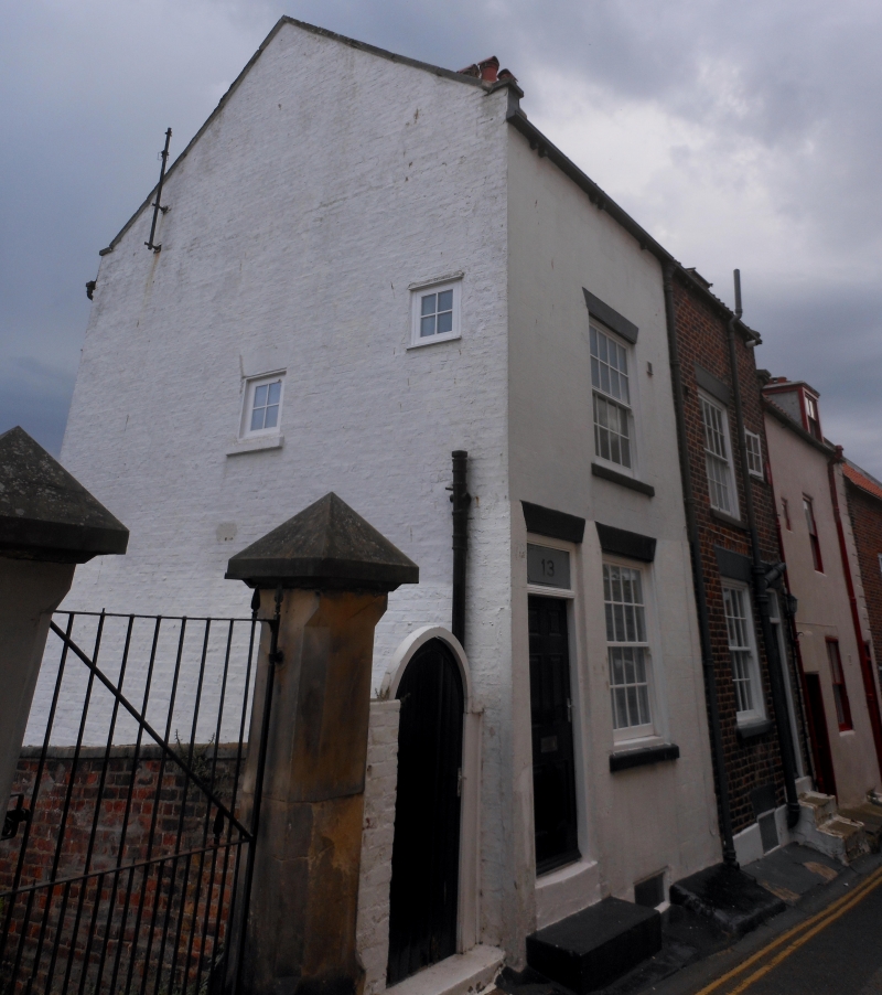
TUTHILL
1.
1605
(South Side)
Nos 11 and 13
TA 0488 4/355
II GV
2.
Early to mid C18 pair of small houses altered early C19. 2 storeys (lower storey
to rear due to sloping site) red brick, No 13 rendered. Steep pitch gable end
old pantile roof. One window each recessed sashes with moulded frames, glazing
bars intact to No 11. Doors each end of 6 fielded panels with rectangular fanlights,
stone steps up.
All the listed buildings on the South Side form a group.
Listing NGR: TA0478988846
External links are from the relevant listing authority and, where applicable, Wikidata. Wikidata IDs may be related buildings as well as this specific building. If you want to add or update a link, you will need to do so by editing the Wikidata entry.


Other nearby listed buildings
