Latitude: 51.4235 / 51°25'24"N
Longitude: -1.7257 / 1°43'32"W
OS Eastings: 419165
OS Northings: 169422
OS Grid: SU191694
Mapcode National: GBR 4X2.NJ0
Mapcode Global: VHC1P.1HJ3
Plus Code: 9C3WC7FF+9P
Entry Name: 24-28, Saint Martins
Listing Date: 21 October 1974
Grade: II
Source: Historic England
Source ID: 1272952
English Heritage Legacy ID: 446889
ID on this website: 101272952
Location: Marlborough, Wiltshire, SN8
County: Wiltshire
Civil Parish: Marlborough
Built-Up Area: Marlborough
Traditional County: Wiltshire
Lieutenancy Area (Ceremonial County): Wiltshire
Tagged with: Building
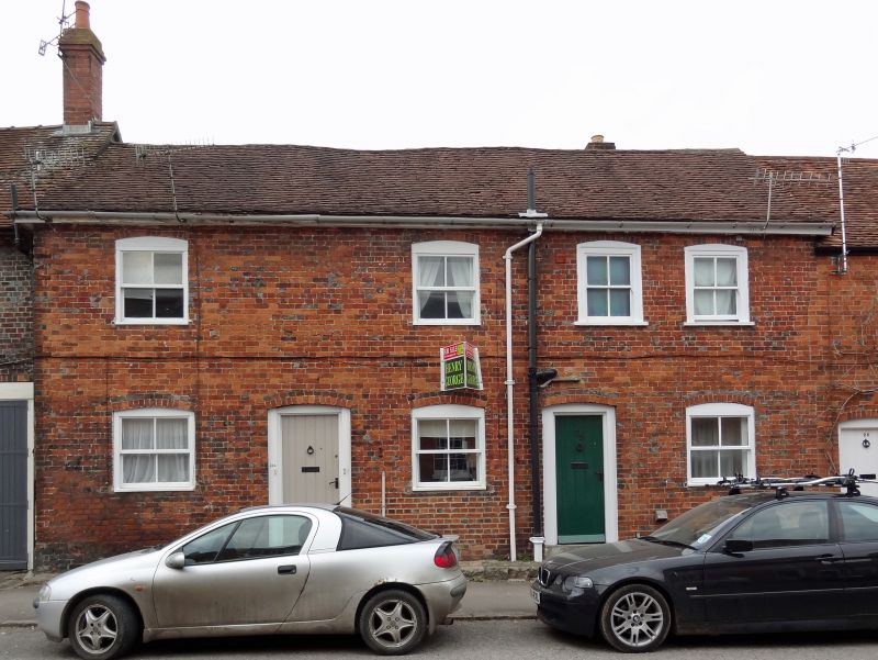
SAINT MARTINS
1.
5407
(North Side)
Nos 24 to 28 (consec)
SU 1969 1/91
II GV
2.
C18. 2 storey. Brick. Old tile roofs. Early C19 casements and C19 saches
and plain doors.
Nos 6 to 28 (consec) form a group.
Listing NGR: SU1916569422
External links are from the relevant listing authority and, where applicable, Wikidata. Wikidata IDs may be related buildings as well as this specific building. If you want to add or update a link, you will need to do so by editing the Wikidata entry.


Other nearby listed buildings