Approximate Location Map
Large Map »
Latitude: 51.4233 / 51°25'23"N
Longitude: -1.7262 / 1°43'34"W
OS Eastings: 419136
OS Northings: 169404
OS Grid: SU191694
Mapcode National: GBR 4X2.NDS
Mapcode Global: VHC1P.1H97
Plus Code: 9C3WC7FF+8G
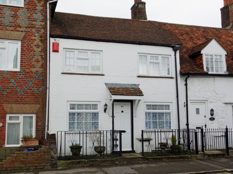
Entry Name: 20, Saint Martins
Listing Date: 21 October 1974
Grade: II
Source: Historic England
Source ID: 1243236
English Heritage Legacy ID: 446885
ID on this website: 101243236
Location: Marlborough, Wiltshire, SN8
County: Wiltshire
Civil Parish: Marlborough
Built-Up Area: Marlborough
Traditional County: Wiltshire
Lieutenancy Area (Ceremonial County): Wiltshire
Tagged with: Building
SAINT MARTINS
1.
5407
(North Side)
No 20
SU 1969 1/299
II GV
2.
Probably early Cl9. Colourwashed brick. Pitched tile roof. Brick stack. 2
storeys. 2 ranges of windows, modern casements with glazing barb on lst floor,
sashes with glazing bars on ground floor. 1 C20 door.
Nos 6 to 28 (consec) form a group.
Listing NGR: SU1913669404
External links are from the relevant listing authority and, where applicable, Wikidata. Wikidata IDs may be related buildings as well as this specific building. If you want to add or update a link, you will need to do so by editing the Wikidata entry.


Other nearby listed buildings
