Approximate Location Map
Large Map »
Latitude: 51.284 / 51°17'2"N
Longitude: 0.1686 / 0°10'7"E
OS Eastings: 551334
OS Northings: 156107
OS Grid: TQ513561
Mapcode National: GBR S9.Z25
Mapcode Global: VHHPK.WZ0K
Plus Code: 9F3275M9+JF
Entry Name: Durham House
Listing Date: 16 January 1975
Grade: II
Source: Historic England
Source ID: 1272968
English Heritage Legacy ID: 446970
ID on this website: 101272968
Location: Riverhead, Sevenoaks, Kent, TN13
County: Kent
District: Sevenoaks
Civil Parish: Riverhead
Built-Up Area: Sevenoaks
Traditional County: Kent
Lieutenancy Area (Ceremonial County): Kent
Church of England Parish: Riverhead St Mary
Church of England Diocese: Rochester
Tagged with: House
1.
5280 RIVERHEAD RIVERHEAD
Chipstead Lane
(North Side)
No 6 (Durham House)
TQ 5156 25/953
II
2.
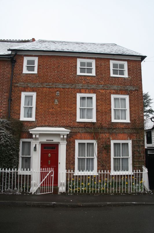
Early C19 house of 3 storeys, 3 windows, irregular. Low pitched, hipped tiled
roof. Red brick with 2 bands of blue headers. Sash windows, lost glazing bars,
in exposed moulded frames. Square pilasters and bracketed hood to door. Sun
assurance sign above it. Wrought iron area railings.
Listing NGR: TQ5133456107
External links are from the relevant listing authority and, where applicable, Wikidata. Wikidata IDs may be related buildings as well as this specific building. If you want to add or update a link, you will need to do so by editing the Wikidata entry.


Other nearby listed buildings
