Approximate Location Map
Large Map »
Latitude: 52.1467 / 52°8'47"N
Longitude: -2.1396 / 2°8'22"W
OS Eastings: 390546
OS Northings: 249828
OS Grid: SO905498
Mapcode National: GBR 1GT.CWD
Mapcode Global: VH931.V9RQ
Plus Code: 9C4V4VW6+M5
Entry Name: Manor Farmhouse
Listing Date: 3 August 1972
Grade: II
Source: Historic England
Source ID: 1273318
English Heritage Legacy ID: 445343
ID on this website: 101273318
Location: Stoulton, Wychavon, Worcestershire, WR7
County: Worcestershire
District: Wychavon
Civil Parish: Stoulton
Traditional County: Worcestershire
Lieutenancy Area (Ceremonial County): Worcestershire
Church of England Parish: Stoulton with Drakes Broughton
Church of England Diocese: Worcester
Tagged with: Farmhouse
STOULTON STOULTON
1.
2501
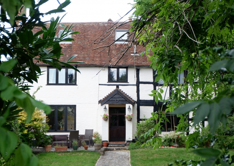
Manor Farmhouse
SO 94 NW 9/780
II
2.
Cl7. Timber frame and painted brick. Tile roof with gable ends. 2-storeys.
3 windows. Casements, bays on ground floor. Continuous hood over centre
door and bays.
Listing NGR: SO9054649828
External links are from the relevant listing authority and, where applicable, Wikidata. Wikidata IDs may be related buildings as well as this specific building. If you want to add or update a link, you will need to do so by editing the Wikidata entry.


Other nearby listed buildings
