Approximate Location Map
Large Map »
Latitude: 51.3302 / 51°19'48"N
Longitude: 0.135 / 0°8'6"E
OS Eastings: 548841
OS Northings: 161170
OS Grid: TQ488611
Mapcode National: GBR RC.W6F
Mapcode Global: VHHPC.9T7P
Plus Code: 9F3284JP+32
Entry Name: Front Garden Wall of the Hall Along Church Road from Corner of Station Road
Listing Date: 16 January 1975
Grade: II
Source: Historic England
Source ID: 1273464
English Heritage Legacy ID: 444814
ID on this website: 101273464
Location: Halstead, Sevenoaks, Kent, TN14
County: Kent
District: Sevenoaks
Civil Parish: Halstead
Built-Up Area: Halstead
Traditional County: Kent
Lieutenancy Area (Ceremonial County): Kent
Church of England Parish: Halstead St Margaret
Church of England Diocese: Rochester
Tagged with: Wall
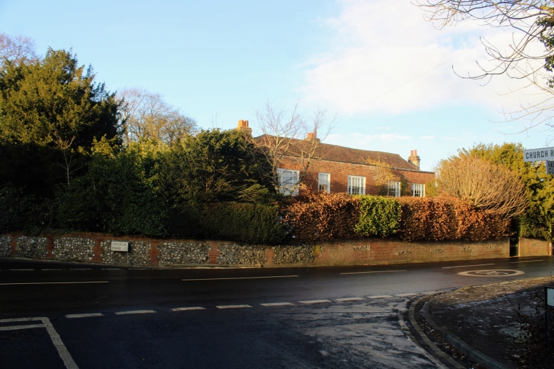
1. HALSTEAD HALSTEAD
5280
Station Road
(West Side)
Front Garden Wall of
The Hall, along Church Road
from corner of Station Road
TQ 4861 14/507
II
2.
Probably early C19 wall of flint rubble with red brick coping. At present being
repaired.
Listing NGR: TQ4884161170
External links are from the relevant listing authority and, where applicable, Wikidata. Wikidata IDs may be related buildings as well as this specific building. If you want to add or update a link, you will need to do so by editing the Wikidata entry.


Other nearby listed buildings
