Approximate Location Map
Large Map »
Latitude: 52.1835 / 52°11'0"N
Longitude: -2.151 / 2°9'3"W
OS Eastings: 389774
OS Northings: 253929
OS Grid: SO897539
Mapcode National: GBR 1GF.30F
Mapcode Global: VH92V.NCQY
Plus Code: 9C4V5RMX+CJ
Entry Name: St Ann's School
Listing Date: 3 August 1972
Grade: II
Source: Historic England
Source ID: 1273493
English Heritage Legacy ID: 444698
ID on this website: 101273493
Location: Spetchley, Wychavon, Worcestershire, WR5
County: Worcestershire
District: Wychavon
Civil Parish: Spetchley
Traditional County: Worcestershire
Lieutenancy Area (Ceremonial County): Worcestershire
Church of England Parish: White Ladies Aston with Churchill and Spetchley
Church of England Diocese: Worcester
Tagged with: School building
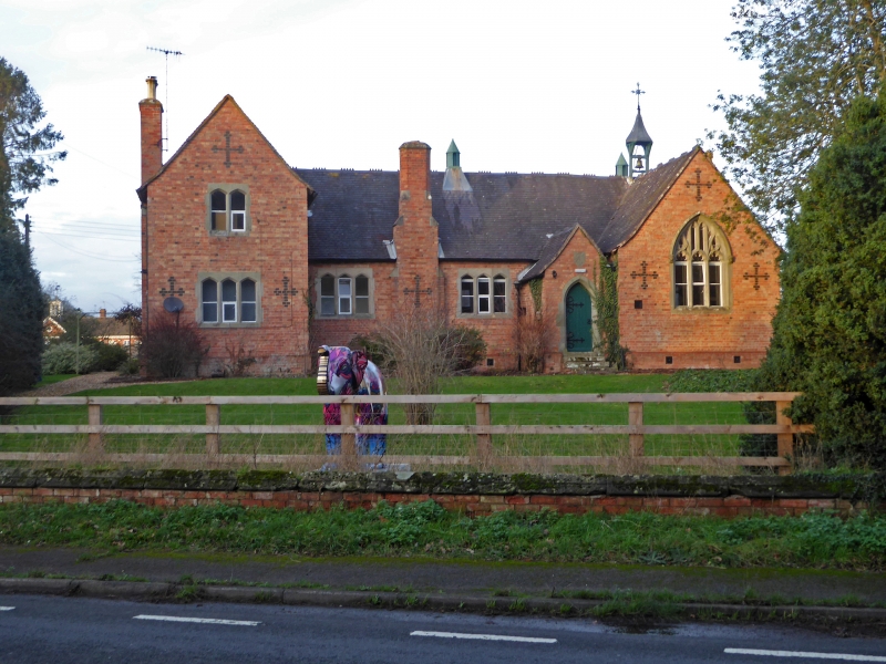
SPETCHLEY SPETCHLEY
1.
2301
St Ann's School
SO 85 SE 4/765
II
2.
184l. By Augustus Welby Northmore Pugin. H-shaped plan. Red brick decorated with blue brick crosses. Perpendicular window in wing. Bell turret.
Listing NGR: SO8977453929
External links are from the relevant listing authority and, where applicable, Wikidata. Wikidata IDs may be related buildings as well as this specific building. If you want to add or update a link, you will need to do so by editing the Wikidata entry.


Other nearby listed buildings
