Latitude: 53.4108 / 53°24'39"N
Longitude: -1.0215 / 1°1'17"W
OS Eastings: 465139
OS Northings: 390894
OS Grid: SK651908
Mapcode National: GBR PY90.N0
Mapcode Global: WHFFV.8JTJ
Plus Code: 9C5WCX6H+89
Entry Name: Barn at Holmefield Farm
Listing Date: 27 November 1984
Grade: II
Source: Historic England
Source ID: 1273708
English Heritage Legacy ID: 417313
ID on this website: 101273708
Location: Scrooby, Bassetlaw, Nottinghamshire, DN10
County: Nottinghamshire
District: Bassetlaw
Civil Parish: Scrooby
Traditional County: Nottinghamshire
Lieutenancy Area (Ceremonial County): Nottinghamshire
Church of England Parish: Scrooby with Ranskill
Church of England Diocese: Southwell and Nottingham
Tagged with: Barn
SK 69 SE SCROOBY CHAPEL LANE (east side)
1/113 Barn at Holmefield Farm
G.V. II
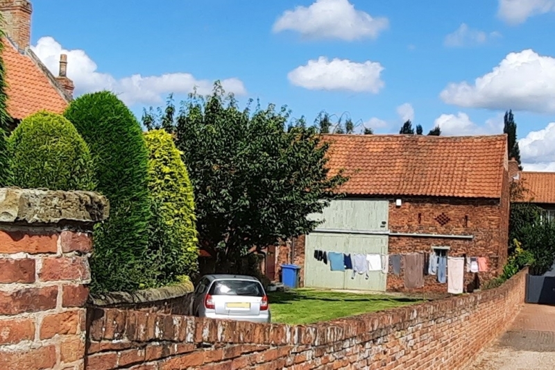
Barn. C17. Refaced C19, originally timber framed and still containing some principal rafters, collar and tie beams of the timber frame roof, now supported on brick piers. Red brick. Pantile roof with brick coped left gable fronting Dog Lane. Having a single small fixed light flanked by single slit ventilators. To the left is a 2-storey doorway with wooden door. Above a single diamond ventilation pattern is flanked by slit ventilators. Attached to the left is a single storey brick lean-to with doorway with wooden door under segmental arch, projecting from the lean-to is a single storey brick wing with single central C20 casement flanked by single doorways, that to the right is under a segmental head. This wing joins the right wing of the house. The left gable of the barn has a re-set ashlar plaque inscribed 'I.T. 1741' - probably taken from the house.
Listing NGR: SK6513990894
External links are from the relevant listing authority and, where applicable, Wikidata. Wikidata IDs may be related buildings as well as this specific building. If you want to add or update a link, you will need to do so by editing the Wikidata entry.


Other nearby listed buildings