Latitude: 51.5149 / 51°30'53"N
Longitude: -0.1303 / 0°7'49"W
OS Eastings: 529832
OS Northings: 181208
OS Grid: TQ298812
Mapcode National: GBR GC.X4
Mapcode Global: VHGQZ.P6G0
Plus Code: 9C3XGV79+XV
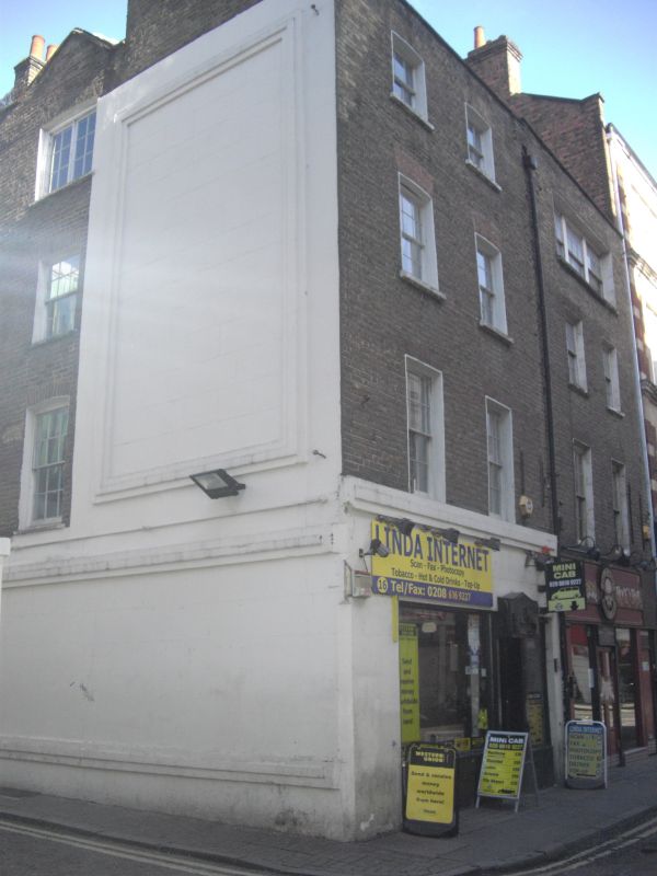
Entry Name: 16 and 17, Manette Street W1
Listing Date: 9 January 1987
Grade: II
Source: Historic England
Source ID: 1273737
English Heritage Legacy ID: 417267
ID on this website: 101273737
Location: Soho, Westminster, London, W1D
County: London
District: City of Westminster
Electoral Ward/Division: West End
Parish: Non Civil Parish
Built-Up Area: City of Westminster
Traditional County: Middlesex
Lieutenancy Area (Ceremonial County): Greater London
Church of England Parish: St Anne Soho
Church of England Diocese: London
Tagged with: Building
TQ 2981 SE CITY OF WESTMINSTER MANETTE STREET, W1 58/110 Nos 16 and 17 9.1.87 - II
Pair of houses, with shops to ground floor. Early to mid C18. Brick; tiled double pitched roofs to parapets. 4 storeys. 2 bays each. C20 shop fronts to ground floor. Square headed windows above, the upper floor of No 17 with continuous 3-light window. Mainly sashes; casements to first and second floors of No 16. surviving interior features including turned baluster staircase and cornices and panelling to No 17.
Listing NGR: TQ2983181209
External links are from the relevant listing authority and, where applicable, Wikidata. Wikidata IDs may be related buildings as well as this specific building. If you want to add or update a link, you will need to do so by editing the Wikidata entry.


Other nearby listed buildings