Latitude: 51.382 / 51°22'55"N
Longitude: 0.2188 / 0°13'7"E
OS Eastings: 554504
OS Northings: 167110
OS Grid: TQ545671
Mapcode National: GBR TS.RTX
Mapcode Global: VHHP6.RJ1D
Plus Code: 9F3296J9+RG
Entry Name: 5 and 6, High Street
Listing Date: 22 October 1982
Grade: II
Source: Historic England
Source ID: 1274319
English Heritage Legacy ID: 415121
ID on this website: 101274319
Location: Farningham, Sevenoaks, Kent, DA4
County: Kent
District: Sevenoaks
Civil Parish: Farningham
Built-Up Area: Eynsford
Traditional County: Kent
Lieutenancy Area (Ceremonial County): Kent
Church of England Parish: Farningham St Peter and St Paul
Church of England Diocese: Rochester
Tagged with: Building
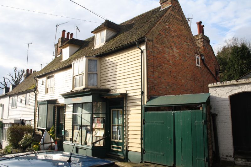
FARNINGHAM HIGH STREET
1.
5280 (south-west side)
Nos 5 and 6
TQ 5467 9/131
II GV
2.
C18. Two parallel ranges. Two storeys and attics faced with weatherboarding.
Tiled roof with 2 hipped dormers. Two sash windows. Modern shopfronts.
Listing NGR: TQ5450567108
External links are from the relevant listing authority and, where applicable, Wikidata. Wikidata IDs may be related buildings as well as this specific building. If you want to add or update a link, you will need to do so by editing the Wikidata entry.


Other nearby listed buildings