Approximate Location Map
Large Map »
Latitude: 50.8657 / 50°51'56"N
Longitude: -0.6347 / 0°38'5"W
OS Eastings: 496172
OS Northings: 108244
OS Grid: SU961082
Mapcode National: GBR FHX.NB7
Mapcode Global: FRA 96KT.8JQ
Plus Code: 9C2XV988+74
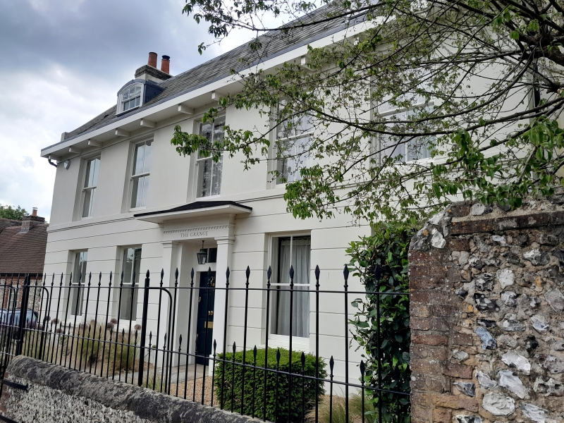
Entry Name: The Grange
Listing Date: 20 September 1984
Grade: II
Source: Historic England
Source ID: 1275050
English Heritage Legacy ID: 298073
ID on this website: 101275050
Location: Slindon, Arun, West Sussex, BN18
County: West Sussex
District: Arun
Civil Parish: Slindon
Built-Up Area: Slindon
Traditional County: Sussex
Lieutenancy Area (Ceremonial County): West Sussex
Church of England Parish: Slindon St Mary
Church of England Diocese: Chichester
Tagged with: Building
SU 9608 SLINDON CHURCH HILL
22/322 (west side)
The Grange
II
Early C19. Two storeys and attic. Five windows. Two dormers with curved heads.
Faced with Roman cement, ground floor rusticated. Stringcourse. Eaves cornice.
Slate roof. Glazing bars missing. Doorway with pilasters, projecting cornice,
rectangular fanlight and door of six fielded panels.
Listing NGR: SU9617308242
External links are from the relevant listing authority and, where applicable, Wikidata. Wikidata IDs may be related buildings as well as this specific building. If you want to add or update a link, you will need to do so by editing the Wikidata entry.


Other nearby listed buildings
